Skip to main content
Collections
People
Sites
Historic events
Related publications
Thesaurus
Advanced Search
Advanced Search Objects: results
Close
Refine Results
Artist / Maker / Culture
Ben Lexcen
(414)
Lars Halvorsen Sons Pty Ltd
(334)
Harold Halvorsen
(197)
Lars Halvorsen
(72)
Trygve Halvorsen
(72)
Professor Peter Numa Joubert
(68)
Johan Valentijn
(46)
Halvorsen Boats Pty Ltd
(43)
Hydrographic Office of the Admiralty
(41)
Roy Martin
(41)
Load all
Artist / Maker / Culture
Classification(s)
*
Maps, charts and plans
(1,632)
Collections
New to the collection
(2)
Under Southern Skies - navigation and voyaging
(2)
Staff favourites
(1)
Date
to
Collection focus areas
Shipping, Trade and Industry
(591)
Maritime Technology
(446)
Travel, Tourism, Sport and Leisure
(404)
Exploration and Colonisation
(102)
Immigration
(39)
Australian Naval History
(36)
Australian - American Maritime Relations
(11)
Environment
(2)
Maritime Archaeology
(1)
Image Available
Sort:
Relevance
Title (A–Z)
Date (Older First)
Object number (Ascending)
Primary Maker (A-Z)
Last Updated (Ascending)
List
Images
Table
Advanced Search
Filters
View PDF
Title
Artist / Maker / Culture
Object number
Description
Date Range
to
Collection focus areas
All
Australian - American Maritime Relations
Australian Naval History
Environment
Exploration and Colonisation
Fleet Services
Immigration
Indigenous Communities
Maritime Archaeology
Maritime Technology
Shipping, Trade and Industry
Travel, Tourism, Sport and Leisure
Classification(s)
All
(not assigned)
Animals and animal products
Armament
Art
Audio visual material
Books and journals
Born digital media
Ceremonial artefact
Clothing and personal items
Coins and medals
Commemorative artefacts
Decorative and folk art
Ephemera
Exhibition
Maps, charts and plans
Models
Photographs
Posters and postcards
Sound communication
Tableware and furnishings
Tools and equipment
Toys, games and souvenirs
Vessels and fittings
Visual communication
In Collection(s)
All
For sickness and health - medicine in the collection
Freshwater Ponds
Gapu-Monuk ~ Saltwater
Guykuḏas Aquarium
Manuscript diaries, journals and logs
Model ships
Music
New to the collection
Sea the world
Sharks
Ship portraits
Shipwrecked: Artefacts from the BATAVIA and Dutch shipwrecks off Western Australia
Staff favourites
Stories in photographs
TỰ DO Vietnamese refugee boat
Under Southern Skies - navigation and voyaging
Valerie Taylor
Whaling
Thesaurus
Thesaurus
Show only matches
There are no search results!
Image Available
Bibliography
Clear
1,632 for
Maps, charts and plans
Clear All Filters
Image Not Available
for Copy of sail plan for intermediate rig design numer 30
Copy of sail plan for intermediate rig design numer 30
Bruce Farr
1972
Image Not Available
for Copy of plan of deck and internal construction of 18 foot racing yacht "KB"
Copy of plan of deck and internal construction of 18 foot racing yacht "KB"
Bruce Farr
1972
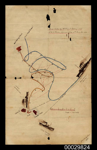
Tracking chart from HMAS SYDNEY II
1940
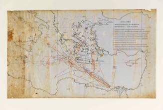
Course taken by HMAS SYDNEY and SMS EMDEN during action 9th November 1914
Albert M Barker
1914
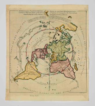
Physical Planisphere Wherein are Represented all the Known Lands and Seas with the Great Chains of Mountains which Traverse the Globe, from the North Pole
Philippe Buache
1757
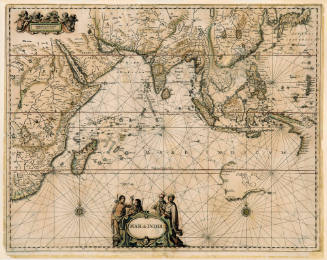
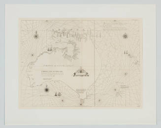
Mar di India
Johannes Janssonius
1650
Van Dieman's Land, drawn up after Swart's facimile of the official map made under Abel Janszoon Tasman's direction of his voyages to discovery of 1642 and 1644
L van der Vegtedal
1898
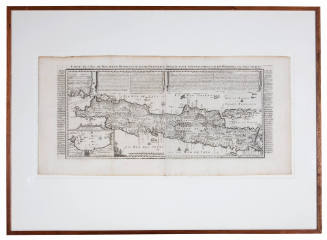
Carte de l'Ile de Java partie Occidentale partie Orientale dresse tout Nouvellement sur Les Memoires les plus exacts
Nicolas Guedeville
1720
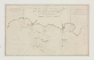
A chart of the coast of Java from Bantam to Batavia
Henry Gregory
1777
Image Not Available
for World Map tracing the journey of KATHLEEN GILLETT
World Map tracing the journey of KATHLEEN GILLETT
HEC Robinson Pty Ltd
1947-1948
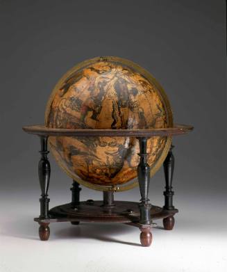
Celestial globe by Willem Janszoon Blaeu
Willem Janszoon Blaeu
1602
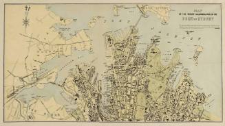
Map of the wharf accommodation of the Port of Sydney
Sydney Harbour Trust
c 1920
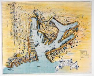
Bird's eye view of general wharfage scheme west of Dawes Point as it will appear when completed
Sydney Harbour Trust
1912
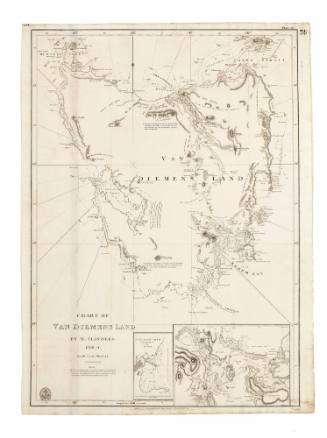
Chart of Van Diemens Land, 1798 - 1799
Matthew Flinders
1840
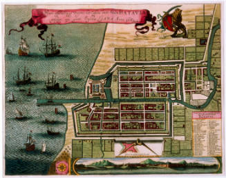
Town plan of Batavia, Java
Frederick De Wit
1681
Image Not Available
for China Sea, Singapore and Keppel Harbour used by KRAIT personnel
China Sea, Singapore and Keppel Harbour used by KRAIT personnel
Hydrographic Office of the Admiralty
1942
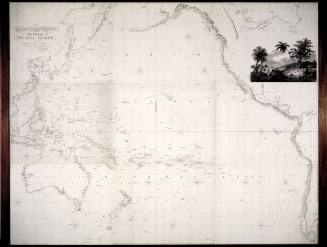
Chart of the Pacific Ocean
Aaron Arrowsmith
1814
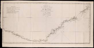
Carte de la Nouvelle Galles Méridionale, ou de la Cote Orientale de la Nouvelle Hollande decouverte et visite par le Lieutenant J Cook, Commandant de l' ENDEAVOUR, vaisseau de sa Majeste en 1770
Robert Bénard
1775
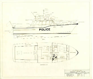
General arrangement plan of a police launch
Trygve Halvorsen
1974
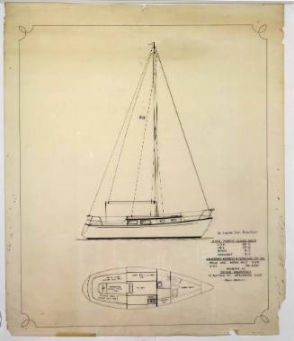
General arrangement plan of a Portia-class yacht
Trygve Halvorsen
1967
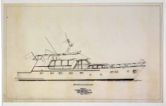
Profile plan of a motor yacht
Trygve Halvorsen
1960s - 1970s
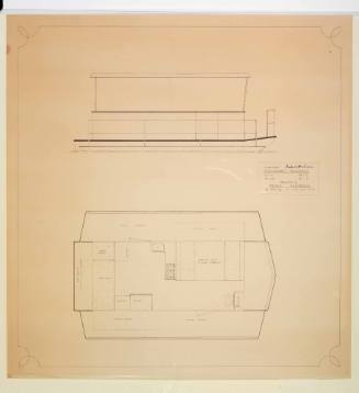
General arrangement plan of a trailerable houseboat
Trygve Halvorsen
1960s - 1970s
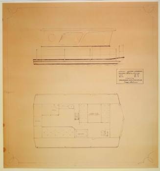
General arrangement plan of a proposed lakes hireboat
Trygve Halvorsen
1960s - 1970s
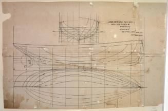
Lines plan for a ketch-rigged mission boat
Lars Halvorsen
1933
Next Page