Topographic map of Gallipoli
Cartographer
Survey Department
Date1915
Object number00039493
NamePlan
MediumMachine made wove paper, printing inks
DimensionsOverall: 630 x 799 mm
ClassificationsMaps, charts and plans
Credit LineANMM Collection Gift from Peter Collins
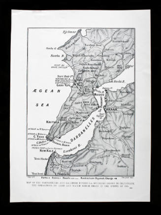
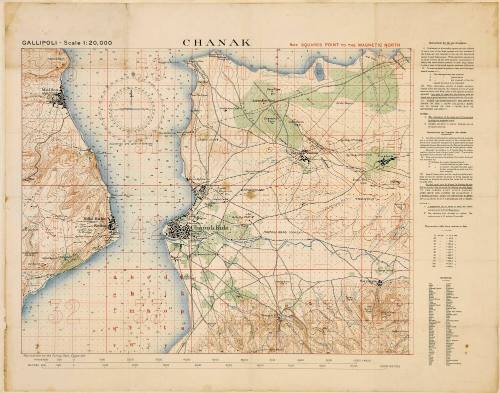
Description1915 military topographic map of 'Chanak', near Gallipoli. The map shows 'the narrows' of the Dardanelles Strait with its series of forts near the town of Çanakkale.