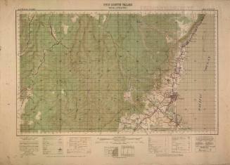
Coastal Charts of Broken Bay used by John 'Jack' O'Brien
Cartographer
Australian Section Imperial General Staff
Printer
AHQ Cartographic Company
Datec 1940
Object number00039654
NameCoastal charts
MediumPaper
Dimensions600 x 870 mm
ClassificationsMaps, charts and plans
Credit LineANMM Collection Gift from the Estate of John Mervin 'Jack' O'Brien
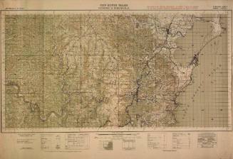
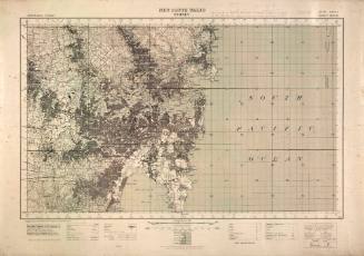
DescriptionJack O'Brien was a surf and fitness enthusiast who was a pioneer of surf ski endurance paddling. O'Brien studied charts of the NSW coast in preparation for his surf ski trips, making notes of potential hazards such as reefs or rocks. This coastal chart depicts the coast of Broken Bay from Collaroy Beach to McMaster Beach.
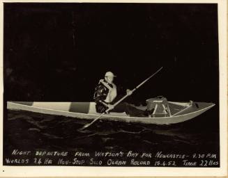
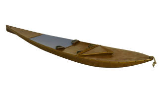
HistoryJohn 'Jack' O'Brien, former Queenscliff lifesaver and professional boxer, was a pioneer of endurance solo paddling using single and double surf skis. Over the course of ten trips from 1940 to 1962 he attempted or set non-stop paddling records on ocean trips between Wollongong, Sydney and Newcastle. His training regime included cycling 48 km a day, following a strict vegetarian diet and 24 hour endurance paddling sessions.
Being tied to his craft in rough seas, navigating by day and night and avoiding hazards such as reefs, rocks and sharks were all part of the challenge. In 1952 he claimed a world record for the greatest distance for non-stop ocean paddling in a 24 hour period, paddling 128km in 22 hours between Watson's Bay and Newcastle. Although his claims were contested in the media and subsequently bettered by others, he is remembered for pushing the boundaries of ocean paddling on surf skis.
Australian Section Imperial General Staff
1942
Australian Section Imperial General Staff
1940s
Australian Section Imperial General Staff
1942
Australian Section Imperial General Staff
1942
Australian Section Imperial General Staff
1941
Australian Section Imperial General Staff
1936