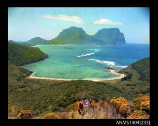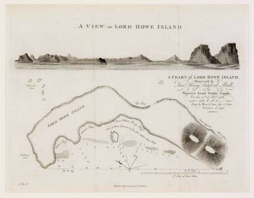
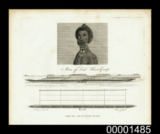
Chart of Lord Howe Island discovered by Lieut Henry Lidgbird Ball in His Majesty's Armed Tender SUPPLY on 17 February 1788; published July 1789
Publisher
John Stockdale
(1750 - 1814)
Engraver
Thomas Medland
(1755 - 1822)
Date1789
Object number00045253
NameChart
MediumEngraving on handmade wove paper
DimensionsSheet: 293 × 459 mm
Image: 265 × 342 mm
Mount / Matt size (B fini mount): 407 × 560 mm
Image: 265 × 342 mm
Mount / Matt size (B fini mount): 407 × 560 mm
ClassificationsMaps, charts and plans
Credit LineANMM Collection
DescriptionChart of Lord Howe Island discovered by Lieutenant Ball, commander of HMS SUPPLY on 17 February 1788 while enroute to Norfolk Island. Lieutenant Ball named the island in honour of Lord Howe First Lord of the Admiralty 1783-1788.HistoryLord Howe Island was discovered by Lieutenant Henry Lidgbird Ball, commander of His Majesty's tender SUPPLY on 17 February 1788 while the vessel was enroute to Norfolk Island. Lieutenant Ball named the island in honour of Lord Howe - First Lord of the Admiralty 1783-1788. In his journal Ball noted that turtles were numerous on the sandy beach within the lagoon and could be taken with little effort. Ball's account and chart of the island were published in The Voyage of Governor Phillip to Botany Bay in London in 1789.SignificanceLord Howe Island was discovered by Lieutent Ball of the SUPPLY in 1788 enroute to Norfolk Island and represents one of the earliest discoveries made by Australia's first European settlers. This chart is a tangible link to the European settlement of Australia.

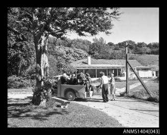
Gervaise Churchill Purcell
c 1951
Gervaise Churchill Purcell
c 1951