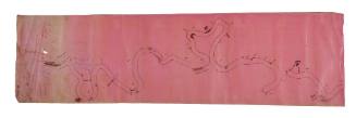
Murray River cloth navigation chart, part 2
Date1880-1920
Object number00056170
NameChart
Mediumink on textile
ClassificationsMaps, charts and plans
Credit LineAustralian National Maritime Museum Collection gift of the Museum of the Riverina
DescriptionTwo piece navigation chart hand-drawn with ink on textile.
The map is of a section of the Murray River starting at the Great Darling Anabranch and continuing west. It would have been created for and most probably by paddle steamer skippers or ship owners. The mapmaker has included notes marking the location of hazards such as rocks, reefs and sandbanks, with instructions to 'keep close' and that there is a 'low water channel between rocks', while a dotted line marks the preferred route for safe passage. The mapmaker has also indentified landmarks and stopover points en route, including Moorna Township, Anabranch Station, Redbank, Ned’s Corner and the location of woolsheds.HistoryThis ink map on cloth was made by a paddle steamer master of vessels on the Murray River run, most probably in the late 19th century when the movement of goods and people inland followed the river systems. The paddle steamers carried wool and wheat to the major transport hubs, and supplies and manufactured goods to river communities. It is a fascinating document showing the geography of the river from the hand of a ship master who knew it well which provides intriguing comparative data about the health of Australia's most important river system today.
This hand drawn map, a pilot chart, is a remarkable document of Murray Darling river history, environmental as much as cultural. It marks the navigation route used by paddle steamers on this section of the Murray west of Anabranch station and identifies natural features, landmarks, river depth, hazards and punctuation points such as stations, woolsheds and stuctures along the journey. Created by a paddle steamer master, the map is born of deep experience and knowledge of the river at the time, and in its free-flowing drawing form is both a mind map and an empirical navigation chart.
SignificanceThis hand drawn chart evokes the importance of the river and of the paddle steamers as a lifeline of trade and transport for Australian settler communities in the late 19th and early twentieth centuries.


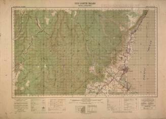
Australian Section Imperial General Staff
1942
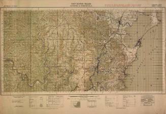
Australian Section Imperial General Staff
1942
Australian Section Imperial General Staff
1942
Australian Section Imperial General Staff
1941
Australian Section Imperial General Staff
1936