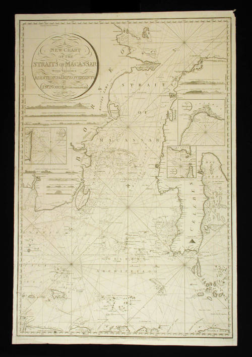
New Chart of the Straits of Macassar with various additions and improvements
Publisher
J W Norie and Company
(1813 - 1843)
Maker
John Stephenson
(British, 1790 - 1836)
Date1832
Object number00004333
NameChart
MediumInk on paper
DimensionsOverall: 1008 x 680 mm
ClassificationsMaps, charts and plans
Credit LineANMM Collection
DescriptionA chart engraved by John Stephenson titled ' A New Chart of the Straits of Macassar with Various Additions and Improvements.' Published in London, England by J.W. Norie & Co. 1832.
Has several inset maps : `Plan of the the Shoals Off Ragged & Shoal Points in Borneo Island', `Straits of Salaya by Jno. Watson' and `Bay of Bonthain by Dalrymple'.
HistoryThe Macassar Straits are a narrow passage of around 800 km northeast–southwest from the Celebes Sea to the Java Sea. The straits pass between Borneo on the west and Celebes on the east and are 80 to 230 miles (130 to 370 km) wide. The deep waterway contains numerous islands, the largest of which are Laut and Sebuku.
The straits were an historically important waterway for trade in the East Indies and other areas of Asia. Accurate maps of the area were important for 18th and 19th century European exploration and commerce.
This chart from 1832 notes 'various additions and improvements' and has several insets including 'Plan of the the shoals off Ragged & Shoal Points in Borneo Island', 'Straits of Salaya by Jno. Watson' and 'Bay of Bonthain by Dalrymple'.
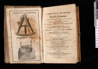
The map was produced by John William Norrie (1772-1843) a hydropgrapher and prolific chart maker during the early nineteenth century, specialising in the sea lanes and coastlines of northern Australia and South East Asia. Several of Norrie's charts were dedicated to the East India Company. He established J.W. Norie & Co. at the Navigation Warehouse and Naval Academy, no. 157 Leadenhall St. London, from the 1810s to 1840s.
William Heather (1790-1812) worked with J W Norrie publishing pilots and charts at the Navigation Warehouse and Naval Academy, along with the engraver J. Stephenson.
SignificanceThe Macassar Straits figured significantly in early European exploration of Australia and South East Asia and were an important trade route between the East Indies and Europe and Australia.

Arthur Pringle
15 May 1892
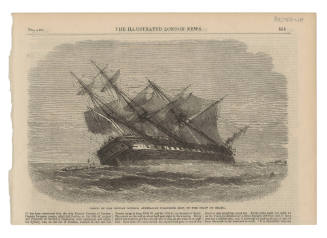
Illustrated London News
1865
John William Norie
1837