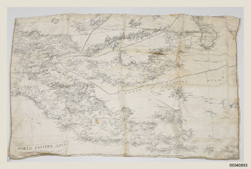
North Eastern Area, New Britain and surrounding waters
Date1946
Object number00040893
NameSilk map
MediumSilk, ink
Dimensions550 x 800 mm
ClassificationsTools and equipment
Credit LineANMM Collection Gift from Peter Horne
DescriptionHMAS COWRA was a minesweeping ship (corvette) working with the South-West Pacific 20th Minesweeping Flotilla. This map depicts the mine clearing area of New Britain and its surrounding waters that was designated to COWRA . Often maps like this were produced on silk to make them easier to fold, conceal and use in wet conditions.HistoryThis silk map of New Britain and surrounding waters was used by members of the 20th Minesweeping Flotilla during mine clearance operations in 1946. In particular this map was used on board HMAS COWRA and shows the area the ship was clearing. Printed in black ink on white silk it illustrates New Britain and surrounding areas, including the Gulf of Papua, D'Entrecasteaux Islands, Trobriand Islands and the South Pacific Ocean.
Maps like this were produced on silk to make them easier to fold and conceal when necessary. They could also be used wet, unlike paper maps. Often special treatments were applied to protect the map from insect or fungal attack.
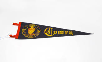
HMAS COWRA was one of 60 minesweepers (commonly referred to as corvettes) built in Australian shipyards as part of the World War II government shipbuilding program. They were named for Australian country towns and cities.
After the war ended, their primary role was in mine clearance operations in the south-west Pacific.SignificanceThis map is indicative of the important work conducted by HMAS COWRA after World War II. Clearing mines was a major duty for the Royal Australian Navy to ensure shipping routes and ports were safe.