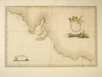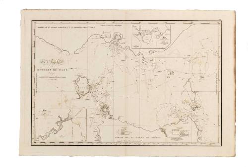
Carte Generale du Detroit de Bass (General chart of Bass Strait)
Cartographer
Louis de Freycinet
(French, 1779 - 1842)
Date1802 - 1803
Object number00040908
NameChart
MediumInk on paper
Dimensions710 x 965 mm
Image: 515 x 765 mm
Image: 515 x 765 mm
ClassificationsMaps, charts and plans
Credit LineANMM Collection
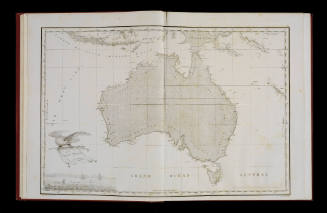
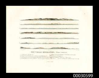
DescriptionChart of Bass Strait surveyed by Louis Freycinet. Louis Freycinet was a young officer with the French expedition to Australia led by Nicolas Baudin in the years 1800 to 1803. Apart from the scientific interests of the expedition, Baudin undertook extensive surveys of parts of the Australian coast, including Bass Strait and the south coast of Australia. Indeed French interest in these areas did much to promote British mistrust and accelerated the founding of British settlements at Port Dalrymple and the Derwent in 1803.
Louis Freycinet returned to Australia in 1818 as leader of another French scientific expedition with the URANIE.HistoryNicolas Baudin sailed from France in command of the ships GEOGRAPHE and NATURALISTE on a scientific expedition to Australia in October 1800. Baudin had previously served in the merchant marine, French Navy (during the American War of Independence), French East India Company and for the Austrian Emperor, Joseph II. He had acquired a reputation as an amateur naturalist after returning from Puerto Rico with a splendid collection of natural specimens in 1797. Based on the success of the Puerto Rico expedition, Baudin proposed a scientific expedition to New Holland. Apart from the scientific interests of the expedition, Baudin planned to survey parts of the Australian coast - particularly those areas as yet only poorly charted. The great French explorer Louis-Antoine de Bougainville was an influential supporter of the expedition and his son Hyacinthe served as a midshipman aboard the GEOGRAPHE. Command of the NATURALISTE was given to Jacques-Felix Hamelin.
While Baudin was given command, he had little control over the selection of scientists and officers, and shipboard tensions were exacerbated by a very slow passage from France to Mauritius. Morale plummeted and several of the officers left the expedition at Mauritius. In May 1801 the expedition reached Cape Leeuwin (WA). Baudin's instructions were to sail south to Tasmania, but with winter approaching, he chose instead to commence surveying north along the west Australian coast - discovering and naming Geographe Bay in the process. The GEOGRAPHE and NATURALISTE separated and while Hamelin undertook a survey of Shark Bay, the two ships only reunited at Timor.
In November the expedition sailed south into the Indian Ocean and then east to Tasmania - arriving there in January 1802. Over the next three months the expedition surveyed much of Bass Strait and the south coast of Australia. Baudin's survey coincided with that of Matthew Flinders in the INVESTIGATOR and an encouter between the two men took place on 8 April 1802 at a place now named Encounter Bay. The period in Tasmania produced a wealth of new geographic information, and the expedition scientists collected abundant natural history specimens, and made important records of the indigenous Tasmanians (Peron producing a study of the Aborigines of Maria Island).
During the survey the GEOGRAPHE and NATURALISTE had acted separately but rendezvoused in Port Jackson in June 1802. At Port Jackson Baudin purchased a smaller vessel, the CASUARINA to replace the slow and cumbersome NATURALISTE which was then sent home to France. Baudin entrusted command to one of his officers - Louis de Freycinet. Over the following year the expedition surveyed more of Bass Strait, King Georges Sound, and the Australian north coast around Bathurst and Melville islands. In August 1803 the expedition returned to Mauritius where Baudin died on 16 September.
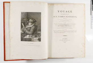
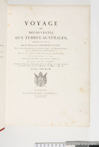
This chart of Bass Strait was published as plate No. 6 of the folio atlas to 'Voyage de decouvertes aux Terres Australes execute sur les corvettes LE GEOGRAPHE, LE NATURALISTE et la goelette LE CASUARINA, pendant les annees 1800, 1801, 1802, 1803 ...' by Louis Claude Desaulses de Freycinet.SignificanceThis detailed chart of Bass Strait is indicative of French interest in this recently discovered and strategic maritime gateway to settlements on Australia's east coast.