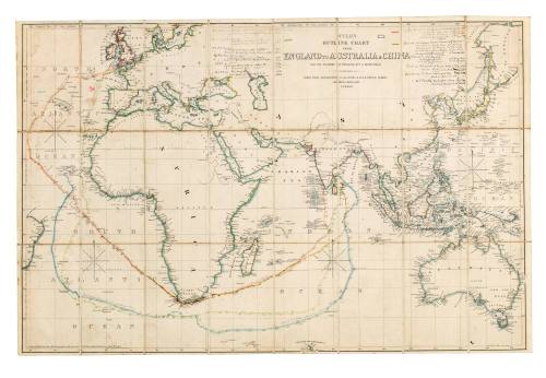
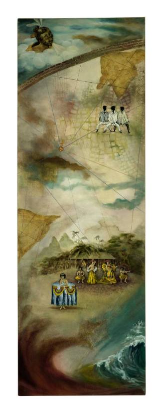
Wyld's Outline Chart from England to Australia and China
Cartographer
James Wyld
(1812-1887)
Date1855
Object number00033898
NameChart
MediumPaper, ink, linen, cardboard
DimensionsOverall: 670 x 1025 x 1 mm
ClassificationsMaps, charts and plans
Credit LineANMM Collection
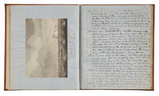
DescriptionThis outline chart is a large-scale observation chart based on the Mercator projection - in which rhumb line courses apear as straight lines - used in the tracking of ships between England, Australia, India and China.
The chart represents the activity of the Wilson, P&O, and British East India Company shipping lines between 1854 and 1888. The voyages of the ships depicted on the chart are CLIVE (1854), EASTERN MONARCH (1858), EARL OF HARDWICKE (1860) and ISABELLA (1861). Other ships mentioned include CANDIA, CANOPUS and DRACCO. The routes of the ships and the outlines of the continents are coloured.
This chart could have been used by one of the ship's officers, an informed passenger or the shipping company to show the general passage of a vessel, or to compare one passage with the next.HistoryThe Wyld family business was started by James Wyld Snr (1790-1836), one of the founders of the Royal Geographical Society. After the death of James Wyld Snr in 1836, his son James Wyld Jnr (1812-1887) became head of the map-publishing firm. He was succeeded by his son John Cooper Wyld who later sold the company in 1893.
Both James Wyld Snr and his son were appointed Geographer to the British Royal Family. Their maps and charts provided detailed coverage of many parts of the world of Imperial interest including Canada, the Caribbean, the Crimea, India, Afghanistan, China, New Zealand, the Australian colonies and surprisingly the United States of America.
James Wyld Snr appears to have begun his cartographic career as a draughtsman working for the Quartermaster General's Office in London. He has been credited with introducing lithography into map printing in England in 1812, and in 1815 he demonstrated his innovative nature by constructing an unusual world map depicting the religion, population and civilisation of each country. Wyld's use of various sizes of Roman numerals in this world map has also been credited with being the first attempt in cartography to employ proportional or graduated symbol to show size and magnitude.
In 1823, James Wyld Snr took over the map and chart business of William Faden and appreciating the market potential for maps of areas being opened up by exploration and immigration, specialised in that area and achieved a worldwide reputation for excellence and accuracy. Wyld's intense cartographic activity and the quality and range of his firm's output earned him universal recognition. He was appointed Geographer to both George IV and William IV and was a founding member of the Royal Geographical Society.
In 1836 James Wyld Snr died at the early age of 46 and his son James Wyld Jnr took over the family firm. Born in 1812 Wyld Jnr had trained at Woolwich for a military career but at the age of 18 opted for cartography joining the firm in 1830. Like his father he was known as a man of 'vigour, flair, independence, and persuasion' and became active in local politics, public debates, campaigns and various causes.
Under Wyld's leadership the firm continued to grow producing maps, charts, atlases and globes showing newly emerging areas, as well as numerous official and semi-official maps, chart and plans of railway, shipping, docks and harbours, as well as public works.
Like his father, Wyld was honoured with royal patronage becoming Geographer to Queen Victoria and Prince Albert. He became the leading London mapmaker of the age and his Charing Cross premises became the haunts of the rich, the powerful and the famous. He became a founding governor of the City and Guilds of London Institute, was awarded 17 European orders including the Legion of Honour and a gold medal from the King of Prussia. He died 1887 aged 74.
SignificanceThis high quality and rare chart is an excellent example of 19th century cartographic skill, and represents the popular interest in charts that showed the tracks of voyages during this period.The Wyld family firm were one of the most renowned of the London-based map, chart and globe manufacturers of the 19th century, and were known for their accuracy and quality of product.
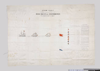
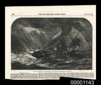
Illustrated London News
1854
Parent (child)/Child (parent)