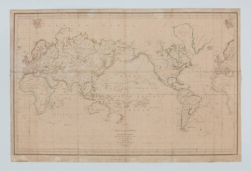
Map of the world illustrating the voyage of La Perouse 1785-1788 with a pencilled track apparently recording the voyage of the MARY from Calcutta to Port Jackson in 1818
Date1798
Object number00045447
NameChart
MediumInk on paper
DimensionsOverall: 660 x 980 x 40 mm
ClassificationsMaps, charts and plans
Credit LineANMM Collection Gift from the children of Nancy Prunster (nee Watkins/Browne)
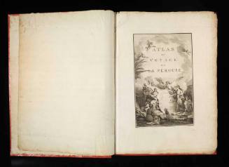
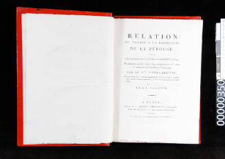
DescriptionThe chart was originally published in Paris in 1797 as part of the 'Atlas du Voyage de La Perouse' which accompanied the four volumes presenting the official account of La Perouse's epic voyage of exploration in the Pacific; the Atlas contains charts and views recorded during La Perouse's voyage between 1785 and 1788.HistoryThe MARY was owned by Calcutta merchants Browne & Turner and had sailed for New South Wales with a cargo of merchandise under command of Captain Benjamin Orman. William Browne (known as Merchant Browne) was the son of an Irish Officer in the East India Company and his Persian wife. Browne first visited New South Wales in 1810. Impressed by the moderate climate, he later moved his household there in 1816. He was granted 3000 acres at 'Athanlin' on the western side of Lake Illawarra. When the vessel MARY arrived in Sydney in July 1818, Browne’s wife, Sophia was on board as a passenger. Advertisements in the Sydney Gazette indicate that Browne also owned a property in Macquarie Place at that time.
Browne imported Indian labourers to work his grant and one of these, Ramdial was the only Hindu listed in the colony in the 1828 census. William Browne died in 1833 and was buried at Wollongong.
Jean-Francois de Galaup, Comte de la Perouse was born in Albi, south-west France in 1741; he joined the French Navy in 1756. He served in North America, the West Indies and in the Indian Ocean during the Seven Years War (1756 - 1763) and in the American War of Independence. By 1783 La Perouse was a post-captain, a Knight of the Order of St. Louis and had become an adviser to the senior naval administrator, Count Claret de Fleurieu. In the period of peace following the Treaty of Paris (1783), Fleurieu and La Perouse began planning for a major French scientific expedition to the Pacific. King Louis XVI took a personal interest in the planning; and consequently the expedition was extremely well-equipped and manned.
Commanding the expedition ships LA BOUSSOLE and L'ASTROLABE, La Perouse left France in 1785 and sailed for the Pacific by way of Cape Horn. The expedition arrived in Chile in February 1786 and then sailed to Easter Island and the Hawaiian islands before carrying out a detailed survey of the north-west coast of North America. It was during this survey that 21 men were lost when their boat capsized in Lituya Bay.
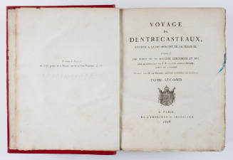
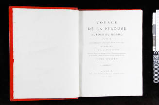
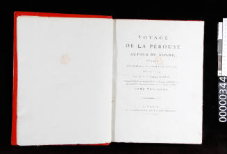
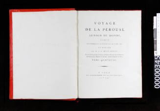
In September 1786 the expedition left the Spanish settlement at Monterey (California) and sailed west across the North Pacific Ocean to Macao where they arrived in January 1787. The expedition then sailed to the Philippines and continued north-eastward to survey the seas around Japan and Korea. In early September 1787 the ships reached the Russian settlement of Petropavlovsk (Southern Kamchatka) where La Perouse received revised orders from France to sail to Botany Bay where a new English colony was about to be settled. At Petropavlovsk La Perouse took the opportunity to send an account of his voyage overland back to Paris with one of his officers, Jean Baptiste Barthelemy de Lesseps. De Lesseps took a year to make the journey to Paris but successfully presented La Perouse's account of the expedition to French government officials. It proved to be the last correspondence received from La Perouse and was later published in 1797 as 'Voyage de La Perouse Autour du Monde', edited by General Milet-Mureau.
From Petropavlovsk the expedition sailed for Botany Bay in New Holland (Australia) by way of Samoa, Tonga and Norfolk Island. At Tutuila in Samoa the expedition suffered a serious setback when Paul-Antoine Fleuriot de Langle (second-in-command) and 11 others were killed by the natives while attempting to obtain fresh water. Despite this tragedy, La Perouse sailed on to Botany Bay, arriving there just as the fleet of British ships carrying the first European settlers departed for the newly-discovered and superior harbour of Port Jackson a few kilometres to the north. The French ships remained at Botany Bay until 10 March 1788 when La Perouse sailed north-west into the Pacific to complete his ambitious exploration. It was thought that La Perouse would pass through Torres Strait before crossing the Arafura Sea to the Indian Ocean and finally return to France. But when, by 1791, no further news of the expedition had reached France, authorities hurriedly directed Bruny d'Entrecasteaux to lead an expedition in search of La Perouse's missing ships.
D'Entrecasteaux's ships LA RECHERCHE and L'ESPERANCE left France in late September 1791. However, despite searching the western Pacific, the expedition found no evidence to explain the disappearance of La Perouse. The mystery of what had happened to the expedition remained unsolved until wreckage of the BOUSSOLE and ASTROLABE was discovered at Vanikoro Island in the Solomon islands by the Franco- Irish adventurer Peter Dillon in 1827.
A year later, the French commander Jules-Sebastien-Cesar Dumont d'Urville visited Vanikoro to confirm the identity of the wreckage and erected a monument to La Perouse. Dumont d'Urville also recovered anchors and cannon from the wreck site on the south-western side of the island which he took back to France. These were used to erect a memorial to La Perouse at his birthplace of Albi.
Since the 1980s a number of Franco-Australian maritime archaeological expeditions visited Vanikoro and, with the consent of the Solomon Islands' government, recovered material from underwater and on land. It is now believed that the La Perouse expedition encountered a cyclone which forced the BOUSSOLE and ASTROLABE onto the reefs at Vanikoro. Archaeological evidence indicates a substantial number of the crew survived the wrecking, but their ultimate fate remains unclear. At the time of Dillon's first visit in 1826, islanders related that the last of the survivors had only died a few years before Dillon's arrival.
A collection of archaeological material from Vanikoro is now held in the Musée National de la Marine in Paris and the Musée d'Histoire Maritime de Nouvelle Caledonie in Noumea.
SignificanceThis is the first English edition of a chart that was originally published in Paris in 1797 as part of the 'Atlas du Voyage de La Perouse', which accompanied the four volumes presenting the official account of La Perouse's epic voyage of exploration in the Pacific; an atlas containing charts and views recorded during La Perouse's voyage between 1785 and 1788.
This English edition was published in 1798 by GG & J Robinson. Of particular interest is a pencilled voyage track from Calcutta to Port Jackson apparently recording the voyage of the ship MARY in the year 1818.
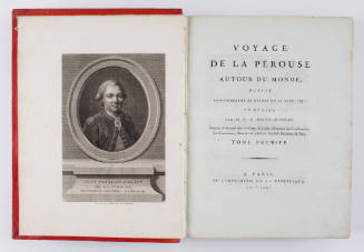
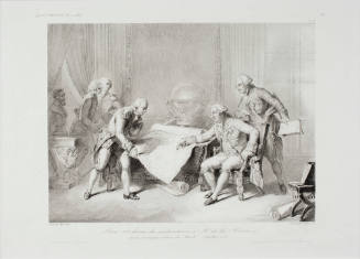
Nicholas-Andre Monsiau
1817