


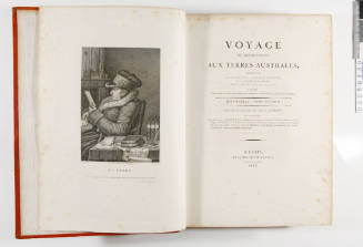
Voyage de Decouvertes aux Terres Australes, atlas
Editor
Louis de Freycinet
(French, 1779 - 1842)
Date1816
Object number00050333
NameAtlas
MediumWove paper, printing ink
DimensionsOverall: 565 x 450 x 30 mm
ClassificationsBooks and journals
Credit LineANMM Collection
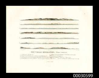
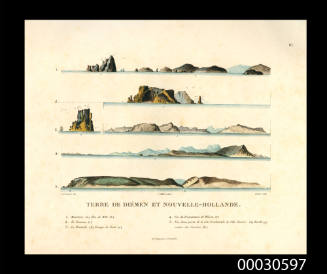
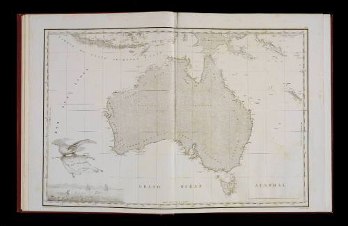
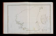
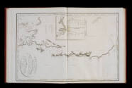
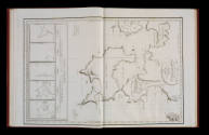
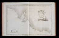
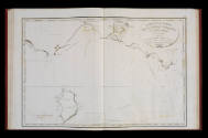
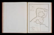
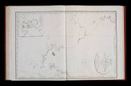
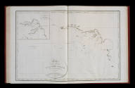
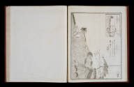
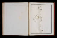
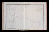
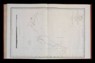
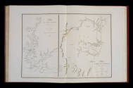
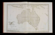
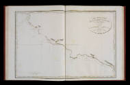
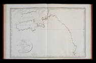
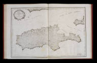
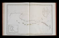
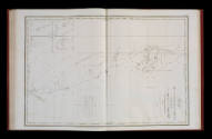
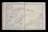
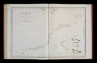
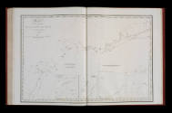
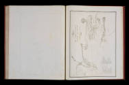
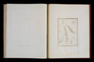
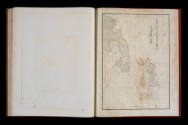
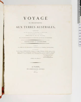
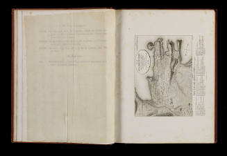
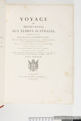
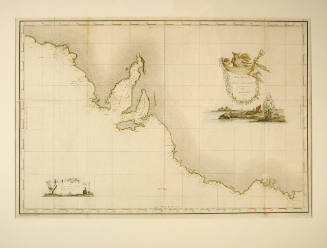
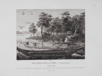
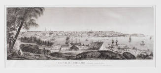
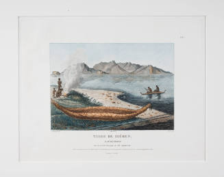
Description'Voyage Aux Terres Australes Historique. Atlas for Voyage de Decouvertes aux Terres Australes, execute sur les corvettes LE GEOGRAPHE, LE NATURALISTE, et la Goelette LE CASUARINA, pendant les annees 1800, 1801, 1802, 1803 et 1804' ('Atlas Travel Discoveries for the Southern Lands, executed on corvettes THE GEOGRAPHE THE NATURALISTE, and Schooner THE CASUARINA during the years 1800 , 1801 , 1802, 1803 and 1804').
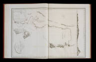
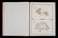
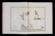
This volume contains 32 charts showing the large areas of the Australian coastline explored by Nicolas Baudin's expedition between 1801 and 1803. After the death of Baudin and then of Peron responsibility for publishing the results of the expedition fell to Louis de Freycinet. This atlas forms part of the complete five volume voyage account.HistoryNicolas Baudin sailed from France in October 1800 in command of the ships LE GEOGRAPHE and LA NATURALISTE on a scientific expedition to Australia. Baudin had previously served in the merchant marine, the French Navy (during the American War of Independence), the French East India Company and in the service of the Austro-Hungarian Emperor, Joseph II. He had established a good reputation as an amateur naturalist after returning from Puerto Rico with a splendid collection of natural history specimens in 1797.
Based on the success of the Puerto Rico expedition, Baudin proposed a scientific expedition to New Holland. In addition to achieving the scientific objectives of the expedition, Baudin planned to survey parts of the Australian coast - particularly those areas that were still poorly charted. The great French explorer Louis-Antoine de Bougainville was an influential supporter of the expedition and his son, Hyacinthe de Bougainville, served as a midshipman aboard LE GEOGRAPHE. Command of the LA NATURALISTE was by Lt. Cdr. Jacques-Felix Hamelin.
Although Baudin had been given overall command, he had had little control over the selection of the scientists and many of the officers; shipboard tensions that subsequently arose during the voyage were exacerbated by the expedition's slow passage from France to Mauritius. Morale plummeted and consequently several disaffected officers left the expedition at Mauritius.
In May 1801 the expedition reached Cape Leeuwin in Western Australia. Baudin's instructions were to sail south to Tasmania, but with winter approaching, he chose instead to commence surveying north along the west Australian coast - discovering and naming Geographe Bay in the process. The GEOGRAPHE and NATURALISTE separated and Hamelin undertook a survey of Shark Bay, with the two ships arranging to reunite in Timor.
In November 1801 the expedition sailed south into the Indian Ocean and then east towards Van Diemen's Land (Tasmania) arriving there in January 1802. Over the next three months the expedition surveyed much of Bass Strait and the south coast of Australia.
Baudin's survey coincided with that of Matthew Flinders in HMS INVESTIGATOR; an encounter between the two expeditions took place on 8 April 1802 at a place named Encounter Bay. Although Flinders' charts have come to be accepted as the more detailed and accurate of the two, Baudin's work was published three years prior to Flinders' and offered the first comprehensive surveys of the Australian coastline.
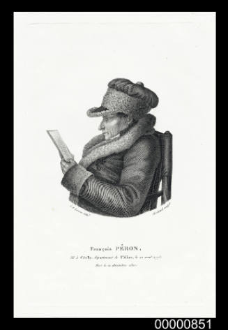
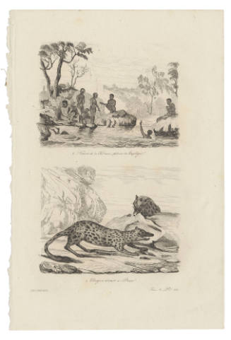
Baudin's period in Tasmania produced a wealth of new geographical and anthropological information; the expedition's scientists collected an abundance of natural history specimens and also made important observations and records documenting indigenous Tasmanians (Peron produced a study of the Aborigines of Maria Island).
During the survey the GEOGRAPHE and NATURALISTE had mainly acted independently of each other, but in 1802 Port Jackson was chosen as a place for a rendezvous. At Port Jackson Baudin purchased a smaller vessel, the locally-built CASUARINA, to replace the slow and cumbersome NATURALISTE which was sent home early to France. De Freycinet was given command of the CASUARINA.
During the following year the expedition surveyed more of Bass Strait, King George's Sound, and the north coast of New Holland around Bathurst and Melville islands.
In August 1803 the expedition returned to Mauritius where Baudin died on 16 September 1803. As a result of Baudin's death, the expedition's charts were produced by Louis de Freycinet, the expedition's hydro-cartographer.
SignificanceFreycinet's atlas and text is a stunning outcome of the Baudin expedition, highlighting the intense French interest in Australia at the beginning of the nineteenth century. It was during this expedition that Baudin and Flinders famously met at Encounter Bay on the south coast of Australia, and both expeditions are historically interlinked.
Louis Auguste de Sainson
1834