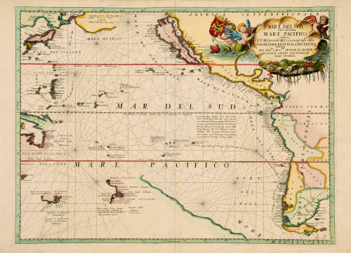
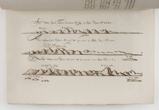
Mare Del Sud detto altrimenti Mare Pacifico
Cartographer
Vincenzo Maria Coronelli
(Venetian, 1650 - 1718)
Date1696
Object number00050669
NameMap
MediumPaper, ink
DimensionsOverall (Sheet): 490 × 685 mm
Mount / Matt size (D Fini Mount): 630 × 865 mm
Mount / Matt size (D Fini Mount): 630 × 865 mm
ClassificationsMaps, charts and plans
Credit LineANMM Collection
DescriptionThis beautifully decorated chart reveals just how little was known about the Pacific Ocean in the late 17th century. Showing Tasman's discoveries in Van Diemen's Land (Tasmania) and New Zealand, the ocean is mostly empty apart from an imaginary blue coastline at centre. It was this 'blank canvas' that James Cook filled between 1769 and 1779.
HistoryVincenzo Maria Coronelli (1650-1718) is widely recognised as one of Italy’s most famous and greatest cartographers. Born in Venice, he received an ecclesiastical education at the convent of the Minor Conventuals and also studied theology in Rome. However, his interests in geography and cartography were awoken early in his ecclesiastical career and never suppressed.
Coronelli constructed two globes for the Duke of Parma and their success insured an invitation to Paris where he was to construct another, very large-scale (some 15 feet in diameter) pair of globes for Louis XIV. The scale of these globes was such that they were created with trapdoors for the craftsmen to enter so that they could be worked on from the inside as well as from outside. These globes bore painted rather than printed detail.
However, Coronelli went on to produce printed globe gores – these were published in book format in 1697 in the Libri Dei Globi. He also produced a range of pocket-sized globes. This variety, accuracy and attention to detail in his globe-making assured his reputation across Europe. In 1680 Coronelli also founded the oldest surviving geographical society - the Academia Cosmografica degli Argonauti.
As ‘Map-maker Royal’ to Louis XIV, Coronelli was based in Paris from 1681 to 1683. Here he had access to the latest French manuscript records, which he incorporated into his printed maps. Coronelli also published numbers of important maps in conjunction with the French publisher, Jean Baptiste Nolin. Nolin had engraved aset of celestial globe gores for Coronelli in 1688 and went on to become the French publisher of Coronelli’s maps. These maps, although comparable to the Italian versions, are appreciably scarcer, as they seem not to have been included in regularly produced atlases.
Coronelli also published the Atlante Veneto (1691-1696), which was intended as a continuation of the Blaeu Atlas Maior. This vast work comprised some thirteen volumes and a wealth of information. Lists were included of ancient and modern geographers along with astronomical, geographical, historical and ecclesiastical detail. The maps from the Atlante Veneto are engraved in characteristic fine bold style, using the latest geographical information available. Many of the more important maps were engraved on two sheets, to allow greater detail.
[Sourced from Dictionary of Map Makers]SignificanceThis chart is significant as a reflection of geographic knowledge about the Pacific Ocean in the late 17th century. It provides an historical context for the great exploratory voyages of the 18th century which filled the voids on the Pacific canvas.
Vincenzo Maria Coronelli
1693
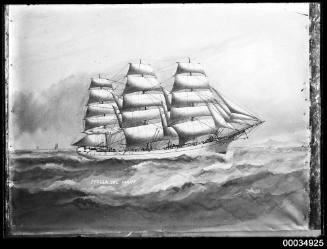
Lloyd Triestino
25 October 1965
February 1938