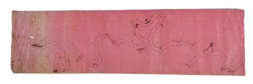
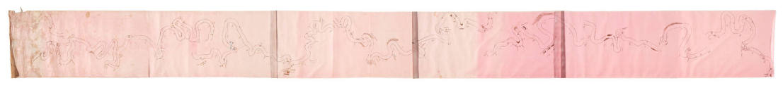
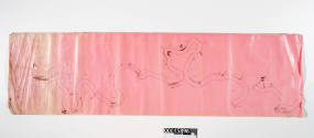

Captain H Hart's map of the Murray River
Maker
Captain H Hart
Date1880s
Object numberV00045896
NameChart
Mediumlinen, ink and pencil
ClassificationsMaps, charts and plans
Credit LineANMM Collection
DescriptionOne of two sections of a cloth navigation chart of the Murray River, made and signed by Captain H Hart, about 1880s.
The two pieces of linen respectively cover river miles 827- 851, from the junction of the Murray and Darling Rivers at Wentworth, and river miles 596-700, from Smith's Wood Pile to Giles Island. Captain Hart notes landings, landmarks such as houses or farm buildings, and hazards such as rocks and sand banks.
Also see 00045897.HistoryCaptain H Hart owned or part owned the paddle steamers VICTOR, VICTORIA and EXCELSIOR. He is listed in Sands & McDougal South Australian Directory as a mariner residing at Morgan from 1886-1891.
Morgan was one of the busiest river ports in the era of river trade and was originally the point at which overlanders with their stock would leave the river on their journey to Adelaide.SignificanceThe inland river trades on the Murray Darling river system are an essential area in Australian European history and development. Until they were superseded in the mid-20th century, the paddle steamers and the rivers they plied were a major supply line for primary produce such as wool and wheat from inland stations, and for manufactured goods and supplies to the inland. The charts drawn by river steamer masters display the knowledge and experience of the people who operated these trades, and were vital in the economic and social develoment of the inland.

Samuel J Hood Studio
28 July 1925
Parent (child)/Child (parent)