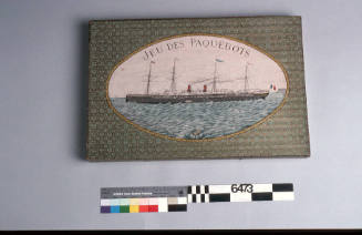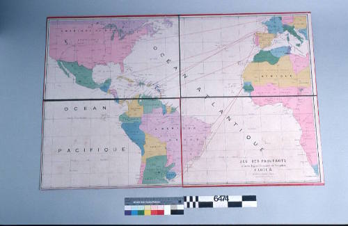
Jeu des Paquebots Grandes Lignes Francaise de Navigation - Carte A
Date1870s
Object number00006474
NameBoard Game Chart
MediumInk on paper
DimensionsOverall: 655 mm, 0.7 kg
ClassificationsToys, games and souvenirs
Credit LineANMM Collection
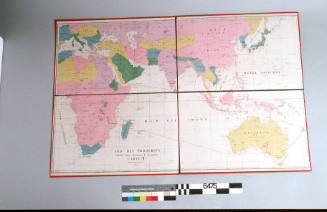
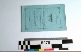
DescriptionA map from the board game 'Jeu des Paquebots'(Game of Cruise Ships) 00006473.
The map (A) is centred on the Atlantic Ocean but also shows the western Pacific Ocean and part of the Mediterranean Sea. The board game map is titled 'Jeu des Paquebots Grandes Lignes Francaise de Navigation - Carte A' ('Game of Lines French Lines of Navigation - Map A').
HistoryThis lavish boardgame, with a typical con joining of educationa lintent and entertainment, displays the sea-routes and world-wide ports by which France and her nineteenth-century colonial empire conducted its maritime life.
Jeudes Paquebots provides a unique opportunity for an insight into late nineteenth-century family amusement at a time when French maritime endeavours were obviously a matter for national pride and statement, even at the level of juvenilia.
By the 1880's board games had gained widespread popularity amongst the middle and upper class. With greater leisure time a demand for fun pursuits increased. Not just for enjoyment however, board games played an important educational and moral role.
Earlier European board games of the 19th century board games had focused on the teaching of rewards for good life choices made whilst playing. A player was rewarded for making the right spiritual decisions and the religious overtones were never far away. Children could be 'taught' through games played at home within the family about actions and consequences. But by the 1880's this view has shifted as the world became smaller and more familiar through commerce, travel and exploration.
Games based on world geography, particularly colonial outposts, were very popular in countries where national pride was immersed its presence overseas. Decorated with pictures of exotic faraway lands, board game adventures kept children interested whilst they learnt of their countries strength and world position.
Travel itself had become more affordable and accessible and shipping lines such as Messageriers Maritime were household names. With a growing middle class looking for tokens of new wealth and prestige, board games were easily acquired and acceptable pastimes.
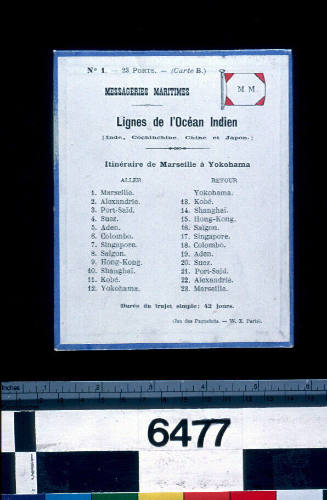
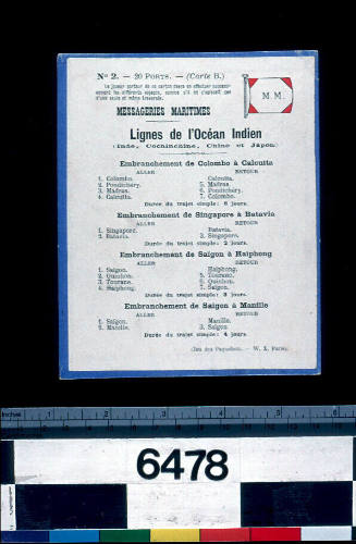
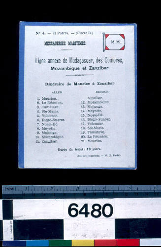
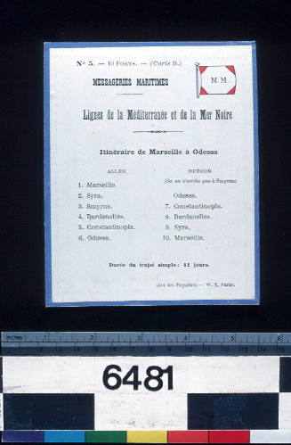
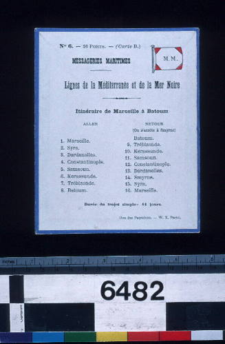
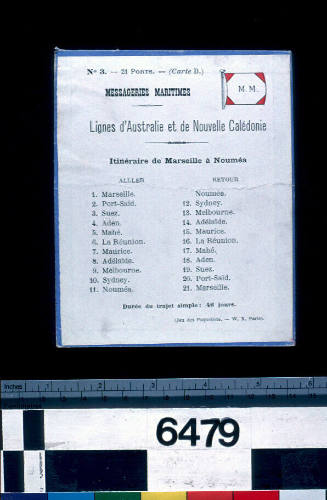
SignificanceA French role in the Pacific begins in the 1760's and concludes with the colonisation of New Caledonia and Tahiti. These and other territories were to be linked culturally and economically to Paris through the shipping company Messageries Maritimes.
Messageries Maritimes [Compagnie des Messageries Maritimes]
1870s
Messageries Maritimes [Compagnie des Messageries Maritimes]
1870s
Messageries Maritimes [Compagnie des Messageries Maritimes]
1870s
Messageries Maritimes [Compagnie des Messageries Maritimes]
1870s
Messageries Maritimes [Compagnie des Messageries Maritimes]
1870s
Messageries Maritimes [Compagnie des Messageries Maritimes]
1870s
Messageries Maritimes [Compagnie des Messageries Maritimes]
1870s
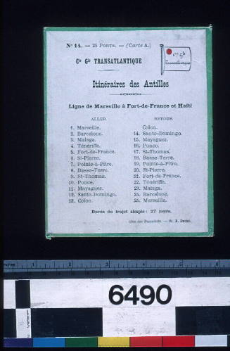
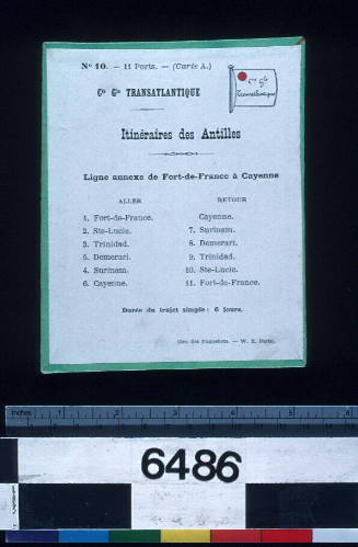
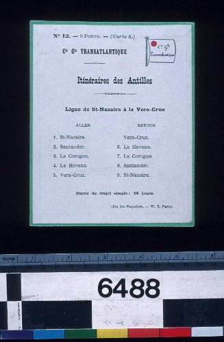
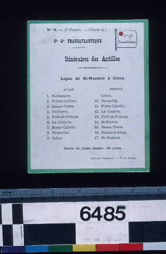
Compagnie Generale Transatlantique Ligne
1870s
Compagnie Generale Transatlantique Ligne
1870s
Compagnie Generale Transatlantique Ligne
1870s
Compagnie Generale Transatlantique Ligne
1870s
Parent (child)/Child (parent)