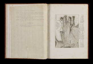
Sea Rivalry
Engraver
Geoffrey Chapman Ingleton
(Australian, 1908 - 1998)
Artist
Geoffrey Chapman Ingleton
(Australian, 1908 - 1998)
Datec 1930
Object number00004836
DCMITypeStill image
NameEtching
MediumPrinted ink on paper
DimensionsOverall: 49.7 x 44.7 mm
ClassificationsArt
Credit LineANMM Collection
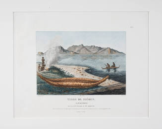
DescriptionThe chance meeting between Matthew Flinders' HMS INVESTIGATOR and Nicolas Baudin's LE GEOGRAPHE in Encounter Bay was a surprise for both. This print by Geoffrey Ingleton is number 10 of 50 and depicts the encounter on 8 April 1802. It hints at the rivalry that existed between the two explorers, both attempting to chart the Australian coastline. During the meeting Flinders and Baudin exchanged information and although Baudin was the first to publish his charts, Flinders is respected as the more skilled surveyor of the two and the first to chart many parts of Australia's coast.HistoryThe encounter between Matthew Flinders' ship HMS INVESTIGATOR and Nicolas Baudin's LE GEOGRAPHE was not sketched or painted by any crew member in 1802, despite there being two official artists on board each vessel. However the meeting has proved to be a popular topic with 20th century artists.
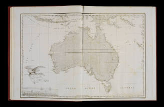
The chance meeting occurred on 8 April 1802. Both vessels were surprised to see each other in the uncharted territory of South Australia, soon to be named Encounter Bay in honour of their meeting. After the French made signals of friendship Flinders boarded LE GEOGRAPHE to exchange information with Baudin, an effort that was hindered by language barriers. Both the British and French captains were charting the coast of New Holland (Australia) and attempting to complete survey information missing on cartographic maps of the period.
Their ships coincided once more in Port Jackson, just two months after this initial meeting in South Australia. Flinders in the INVESTIGATOR was the first to make a complete circumnavigation of Australia and produce detailed charts of its coast. His maps are regarded as significantly more detailed and accurate than Baudin's however the French were the first to publish their charts, some three years before Flinders. In doing so they initially took the credit for much of Flinders' discoveries and survey work and ignored his naming of bays, islands etc, preferred to use their own French versions.SignificanceGeoffrey Ingleton is known for his series of works depicting key historical events in Australian maritime history. 'Sea Rivalry' represents the encounter between the French and English expeditions off the South Australian coast.
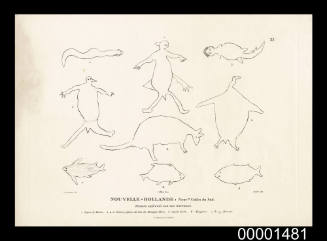
Charles Alexandre Lesueur
1824