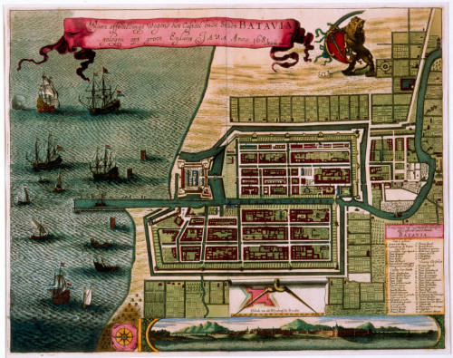
Town plan of Batavia, Java
Artist
Frederick De Wit
(Dutch, 1630 - 1706)
Date1681
Object number00003434
DCMITypeStill image
NameEngraving
MediumInk on paper
DimensionsOverall: 660 x 894 mm, 0.47 kg
ClassificationsMaps, charts and plans
Credit LineANMM Collection
DescriptionThis hand coloured engraving depicts the town plan of Batavia, Java (now Jakarta, Indonesia) and was published in Amsterdam in 1681. The map indicates the factory and town established by Jan Pieterszoon Coen in 1619, the route of the "De Groote Rivier" and smaller rivers, the coastline and eleven ships with Dutch flags anchored in the harbour. A Dutch inscription reads "Waere affbeeloinge wegens het cafteelende stact batavia gelegen opt groot eylant Java anno 1681 F De Wit excudir"
Batavia was the headquarters in Asia for the United Dutch East India Company, or the Vereenigde Oostindische Compagnie (VOC). The layout of the town, the route of the De Groot River and smaller rivers, the coastline and eleven ships bearing Dutch flags are shown in the anchorage off the town.
HistoryDuring the 1600s the Dutch East India Company or Vereenigde Oostindische Compagnie (VOC) was a rapidly expanding merchant organisation, which established a powerful trade network throughout Asia transporting rare spices, textiles and other precious goods to European markets.
The town of Batavia (now Jakarta, Indonesia) became the headquarters for the VOC in Asia. The port was designed in a similar way to a Dutch city, complete with canals, bridges and a castle. Batavia served as a hub for the VOC Fleet. Products bought in various Asian regions were shipped to Batavia and then shipped to Europe or elsewhere in Asia.
The Dutch were known throughout Europe for the quality of the maps they produced. The industry was dominated by a few families over a hundred year period. Cartographers including Hondius, Blaeu, Jansson and Frederick De Wit produced maps that reflected growth in geographical knowledge, yet also featured ornate details and lavish decorations. The Dutch mapmakers merged art and science in the maps and atlases they produced and sold to customers throughout Europe.
De Wit acquired many of the copper plates made by his predecessors Blaeu and Jansson. Jan Jansson was known for his town books, these contained town plans of cities in Europe. The plan of Batavia was first published in 1652 in one of Jansson's town books. This edition is a fine copy published by Frederick De Wit in 1681.
SignificanceThe Dutch settlement of Batavia (now Jakarta, Indonesia) was the base for exploration and trade by the Dutch in Asia during the 17th and 18th centuries. This engraved town plan is a fine example of the coloured maps, plans and charts produced by Dutch mapmakers, when The Netherlands was the most important maritime power in the world.
Jan Huyghen van Linschoten
1595 - 1598

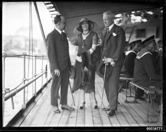
Samuel J Hood Studio
10 October 1930
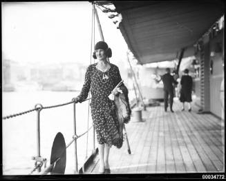
Samuel J Hood Studio
10 October 1930