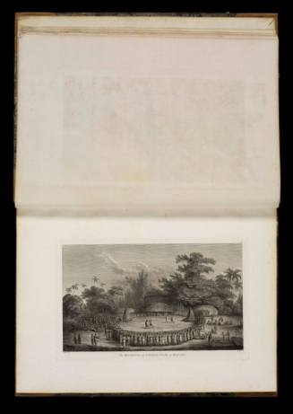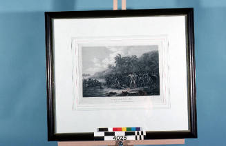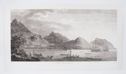
View of Huaheine
Artist
John Webber R.A.
(1751-1793)
Engraver
W Byrne
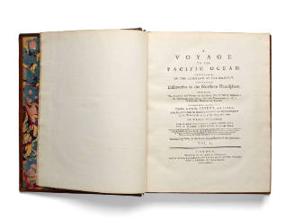
Date1784
Object number00001468
NameEngraving
MediumInk on paper
DimensionsOverall: 523 mm
ClassificationsArt
Credit LineANMM Collection
DescriptionEnraving titled 'View of Huaheine', depicting Cook's ships RESOLUTION and DISCOVERY at Huaheine in the Society Islands. Based on a drawing by John Webber who was the official artist on Captain James Cook's third voyage of exploration from 1776 to 1780.
Cook, aboard the RESOLUTION, visited Huaheine in October, 1777.HistoryJames Cook was on what would become known as his Third Voyage when he stopped again at Huaheine in October 1777. This stop was seen as the occasion to resettle Omahi who had been living in London since 1774 since leaving Huaheine in 1773 and joining Cook's First Voyage. He had acted as interpreter on the voyages but had decided to return home. Cook writes in his journal in October 1777, "Having left Eimeo, with a gentle breeze and fine weather, at daybreak the next morning we saw Huaheine, extending from south west by west, half west, to west by north. At noon we anchored at the north entrance of Owharre harbour, which is on the west side of the island. The whole afternoon was spent in warping the ships into a proper berth, and mooring... As soon as Omai was settled in his new habitation, I began to think of leaving the island."
Cook had his men build Omai a house and garden and Omai had bought with him from London not only supplies and weapons, but also furniture, domestic goods and pigs. When it was time for Cook to leave, he recalls "Omai went ashore, after taking a very affectionate farewell from all the officers. He sustained himself with a manly resolution, til he came to me. Then his utmost efforts to conceal his tears failed; and Mr King who went in the boat, told me that he wept all the time in going ashore."
SignificanceCook's third and fatal voyage, saw him visit the Pacific ocean again and complete what would be part of his great legacy, the mapping of the Pacific Ocean.