Skip to main content
Collections
People
Sites
Historic events
Related publications
Thesaurus
Advanced Search
Image Not Available
for Hydrographic Society, Royal Australian Navy chart of Port Jackson 1972
Expand
View PDF
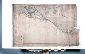
Hydrographic Society, Royal Australian Navy chart of Port Jackson 1972
Previous
Next
Image Not Available
for Hydrographic Society, Royal Australian Navy chart of Port Jackson 1972
Hydrographic Society, Royal Australian Navy chart of Port Jackson 1972
Date
1972
Object number
ANMS0434[028]
Name
Chart
Classifications
Maps, charts and plans
Credit Line
ANMM Collection
Terms
TANAC
ILUKA
Shipping and Trade
Shipping, Trade and Industry
Paper - maps, charts and plans
Discover More
Related
Image Not Available
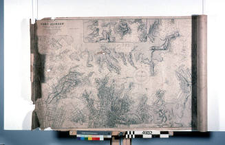
for Hydrographic Society, Royal Australian Navy chart of coast from Jervis Bay to Port Jackson 1957
Hydrographic Society, Royal Australian Navy chart of coast from Jervis Bay to Port Jackson 1957
1957
Image Not Available
for Chart - Port Jackson to Port Stephens used by John 'Jack' O'Brien
Chart - Port Jackson to Port Stephens used by John 'Jack' O'Brien
c 1940
Admiralty Chart: East coast of Australia New South Wales Beecroft Head to Port Jackson
The Admiralty
1915
Admiralty Chart: Australia - east coast, Port Jackson
The Admiralty
1913
Image Not Available
for Port Jackson navigation chart from BLACKMORES FIRST LADY
Port Jackson navigation chart from BLACKMORES FIRST LADY
1972
Image Not Available
for Coastal Charts of Jervis Bay to Port Jackson used by John 'Jack' O'Brien
Coastal Charts of Jervis Bay to Port Jackson used by John 'Jack' O'Brien
1949
Image Not Available
for Port Jackson and Middle Harbour also Parramatta and Lane Cove Rivers
Port Jackson and Middle Harbour also Parramatta and Lane Cove Rivers
Higinbotham & Robinson
1893
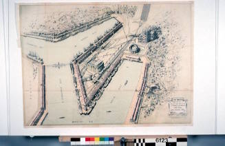
Bird's eye view of terminal grain elevator and proposed cargo berths Glebe Island, Port Jackson, New South Wales
Sydney Harbour Trust
1915
Image Not Available
for Map featured on fourth page of four page report of matters discussed by the committee of Port Jackson and Botany Bay pilots
Map featured on fourth page of four page report of matters discussed by the committee of Port Jackson and Botany Bay pilots
Eric Bolton Beeham
1977
Image Not Available
for Royal Observatory Hong Kong weather chart depicting typhoon movement from January to August 1959
Royal Observatory Hong Kong weather chart depicting typhoon movement from January to August 1959
Eric Bolton Beeham
January 1959 - August 1959
Image Not Available
for Royal Observatory Hong Kong weather chart depicting typhoon movement during September 1958
Royal Observatory Hong Kong weather chart depicting typhoon movement during September 1958
Eric Bolton Beeham
1958
Image Not Available
for Royal Observatory Hong Kong weather chart depicting typhoon movement during September 1958
Royal Observatory Hong Kong weather chart depicting typhoon movement during September 1958
Eric Bolton Beeham
1958
Related
Archive Series (item)/Archive Item (series)
View all
Image Not Available
for Collection of 32 documents relating to MV ILUKA
Collection of 32 documents relating to MV ILUKA