Skip to main content
Collections
People
Sites
Historic events
Related publications
Thesaurus
Advanced Search
Search
Objects
(223)
People
(5)
Historic events
(1)
Close
Refine Results
Artist / Maker / Culture
Thomas Bowen
(1)
O H Bailey & Co
(1)
J Knauber & Co
(1)
Captain James Cook
(1)
C H Vogt
(1)
Thomas Pennant (1726-1798)
(1)
Commander M G H W Ross RN
(1)
Classification(s)
*
Maps, charts and plans
(6)
Date
to
Collection focus areas
Exploration and Colonisation
(3)
Australian - American Maritime Relations
(2)
Shipping, Trade and Industry
(1)
Image Available
Sort:
Relevance
Title (A–Z)
Date (Older First)
Object number (Ascending)
Primary Maker (A-Z)
Last Updated (Ascending)
List
Images
Table
Filters
View PDF
6 results for
arctic
Result type
Objects
People
Historic events
Maps, charts and plans
Clear All Filters
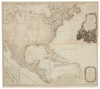
A New Map of North America with the West India Islands Divided According to the Preliminary Articles of Peace, Signed at Versailles 20 January 1783 Wherein are Particularly Distinguished The United States, and the Several Provinces Governments ect. Which Compose The British Dominions
1794
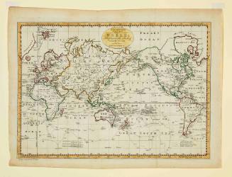
A New and Complete Chart of the World Displaying the Tracks of Captain Cook and other Modern Navigators
Thomas Bowen
c 1784
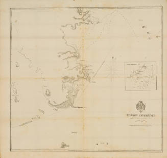
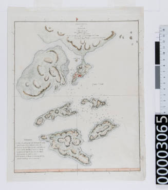
Wilson's Promontory
Commander M G H W Ross RN
1856
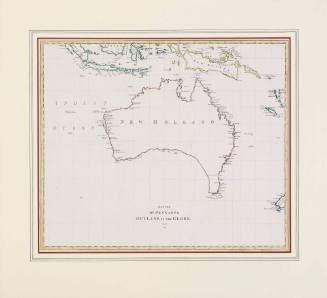
Map for Mr. Pennants Outline of the Globe Vol. IV
Thomas Pennant (1726-1798)
1800
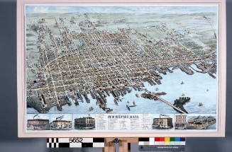
View of the city of New Bedford, Massachusetts
C H Vogt
1876
Sketch of the Typa and Macao
1796
Next Page