Skip to main content
Collections
People
Sites
Related publications
Historic events
Thesaurus
Advanced Search
Advanced Search Objects: results
Close
Refine Results
Artist / Maker / Culture
Hydrographic Office of the Admiralty
(14)
Judy Watson
(6)
Hydrographic Department of the Admiralty
(4)
Captain H Hart
(3)
John Arrowsmith
(3)
Frederick De Wit
(2)
Shaw Savill & Albion Line
(2)
Parbury, Allen & Co.
(2)
Higinbotham & Robinson
(2)
Helen S Tiernan
(2)
Load all
Artist / Maker / Culture
Classification(s)
Maps, charts and plans
(55)
Ephemera
(19)
Art
(14)
Books and journals
(10)
Photographs
(2)
Born digital media
(1)
Commemorative artefacts
(1)
Toys, games and souvenirs
(1)
Collections
Under Southern Skies - navigation and voyaging
(3)
Recently digitised
(2)
Manuscript diaries, journals and logs
(1)
Date
to
Collection focus areas
Exploration and Colonisation
(33)
Shipping, Trade and Industry
(23)
Australian Naval History
(15)
Indigenous Communities
(14)
Travel, Tourism, Sport and Leisure
(10)
Australian - American Maritime Relations
(3)
Immigration
(3)
Maritime Technology
(1)
Image Available
Sort:
Relevance
Title (A–Z)
Date (Older First)
Object number (Ascending)
Primary Maker (A-Z)
Last Updated (Ascending)
List
Images
Table
Advanced Search
Filters
View PDF
Title
Artist / Maker / Culture
Object number
Description
Date Range
to
Collection focus areas
All
Australian - American Maritime Relations
Australian Naval History
Environment
Exploration and Colonisation
Fleet Services
Immigration
Indigenous Communities
Maritime Archaeology
Maritime Technology
Shipping, Trade and Industry
Travel, Tourism, Sport and Leisure
Classification(s)
All
(not assigned)
Animals and animal products
Armament
Art
Audio visual material
Books and journals
Born digital media
Ceremonial artefact
Clothing and personal items
Coins and medals
Commemorative artefacts
Decorative and folk art
Ephemera
Exhibition
Maps, charts and plans
Models
Photographs
Posters and postcards
Sound communication
Tableware and furnishings
Tools and equipment
Toys, games and souvenirs
Vessels and fittings
Visual communication
In Collection(s)
All
Blueback (2022) Collection
For sickness and health - medicine in the collection
Freshwater Ponds
Gapu-Monuk ~ Saltwater
Guykuḏas Aquarium
Manuscript diaries, journals and logs
Model ships
Music
Navigators and Explorers
New to the collection
Ocean Science & Sustainability
Recently digitised
Sea the world
Sharks
Ship portraits
Shipwrecked: Artefacts from the BATAVIA and Dutch shipwrecks off Western Australia
Staff favourites
Stories in photographs
TỰ DO Vietnamese refugee boat
Under Southern Skies - navigation and voyaging
Valerie Taylor
Whaling
Thesaurus
Thesaurus
Show only matches
There are no search results!
Image Available
Bibliography
Clear
102 for
Thesaurus
:
maps
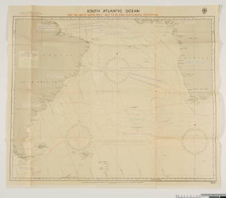
Navigation chart for the South Atlantic Ocean
Hydrographic Department of the Admiralty
1942
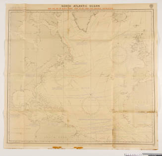
Navigation chart for the North Atlantic Ocean
Hydrographic Department of the Admiralty
1942
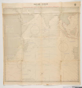
Navigation chart of Indian Ocean November to April
Hydrographic Department of the Admiralty
1942
Image Not Available
for Arnhem Bay, Northern Territory
Arnhem Bay, Northern Territory
Royal Australian Survey Corps
1972
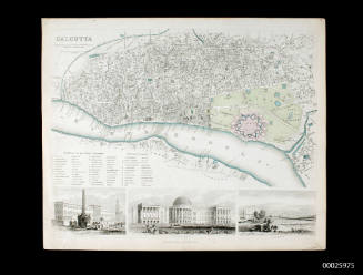
Plan of Calcutta
Charles Knight
1847
Image Not Available
for Northern Explorer
Northern Explorer
1970s
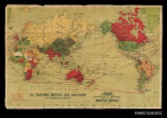
Map of the British Empire
1905-1911
Image Not Available
for Map of Wantirna showing location of Roy Martin's talk on MISS NYLEX
Map of Wantirna showing location of Roy Martin's talk on MISS NYLEX
c 1976
Map of India [Southern part]
Parbury, Allen & Co.
1831
Map of India [Northern part]
Parbury, Allen & Co.
1831
Image Not Available
for Port Jackson and Middle Harbour also Parramatta and Lane Cove Rivers
Port Jackson and Middle Harbour also Parramatta and Lane Cove Rivers
Higinbotham & Robinson
1893
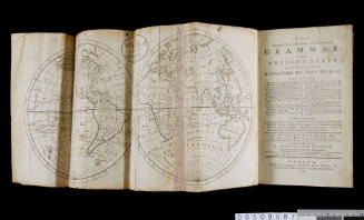
Guthrie's Grammar With Maps
William Guthrie
1787
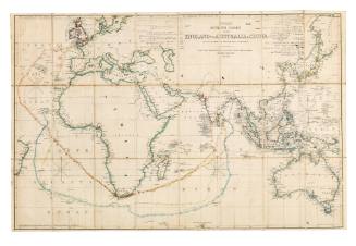
Wyld's Outline Chart from England to Australia and China
James Wyld
1855
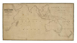
The Indian Ocean and the Whole Navigation between the Cape of Good Hope and China, Australia, New Zealand, etc
James Imray
1853
Image Not Available
for Australia - North Coast, Cape Arnhem to Cape Fourcroy
Australia - North Coast, Cape Arnhem to Cape Fourcroy
Hydrographic Office of the Admiralty
1957-1977
Image Not Available
for Bird's eye view of Sydney Harbour
Bird's eye view of Sydney Harbour
Stewart and Company
c 1889
Image Not Available
for Handmade Map of Ross Island South Victoria Land and the Ross Barrier Surface
Handmade Map of Ross Island South Victoria Land and the Ross Barrier Surface
Sir Lionel Hooke
1915
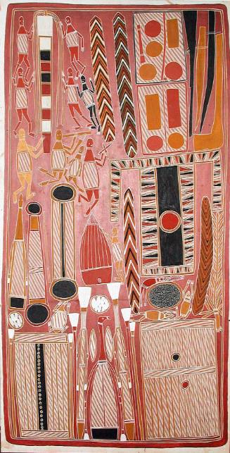
Ganalpingu Cosmology
John Bulun Bulun
c 1994
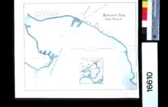
Hobson's Bay, Port Phillip
c 1872
Image Not Available
for Shell map of Australia inspired the Al - Istakhari's map
Shell map of Australia inspired the Al - Istakhari's map
Lola Ryan
c 2001
Image Not Available
for Shellwork map of Australia
Shellwork map of Australia
Lola Ryan
c 2001
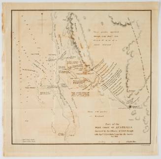
Part of the west coast of Australia Survey by the officers of HMS BEAGLE with Captain J Lort Stokes' route into the interior December 1841
John Arrowsmith
1841
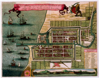
Town plan of Batavia, Java
Frederick De Wit
1681
Image Not Available
for Shell Australia : Bicentenary 1770 - 1970 : His Majesty's Bark ENDEAVOUR
Shell Australia : Bicentenary 1770 - 1970 : His Majesty's Bark ENDEAVOUR
Shell Australia Limited
1970
Next Page
![Map of India [Southern part]](/internal/media/dispatcher/169122/thumbnail)
![Map of India [Northern part]](/internal/media/dispatcher/169123/thumbnail)