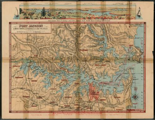
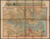
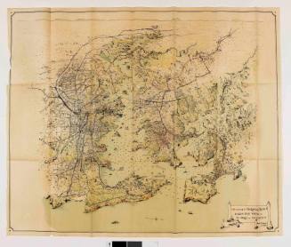
Map of Port Jackson showing Middle Harbour, Parramatta and Lane Cove Rivers
Date1893
Object number00048227
NameMap
MediumLithograph, ink on paper
DimensionsOverall: 430 x 557 mm
ClassificationsMaps, charts and plans
Credit LineANMM Collection Gift from John Stanley
DescriptionThis fold out map provides a snap shot of Port Jackson and associated waterways and suburbs in 1893 with details of some of the commercial and recreational users of the Port as well as advertisements for local businesses and services. The map indicates navigable channels, wharves and jetties, headlands and bays as well as listing storm signals, mail steamer and company house flags and mail signals. Yachting race courses used by the Royal Sydney Yacht Squadron and Royal Prince Alfred Yacht Club are prominently marked while office holders from the Prince Alfred Yacht Squadron are also listed.HistoryIncreasing use of Port Jackson and Sydney Harbour for commercial shipping, fishing and recreational rowing and sailing required increasingly detailed and up to date maps. By 1881 there were at least 77,144 people living in the metropolitan districts of Port Jackson that included harbour and lower esturary foreshore. The Sydney Harbour Trust was established in 1901 to manage the public waterfront and was responsible to a new State government.SignificanceThis map reflects how Port Jackson was being used in the late ninteenth century for commercial and recreational purposes and provides details on Sydney business through associated advertisements.