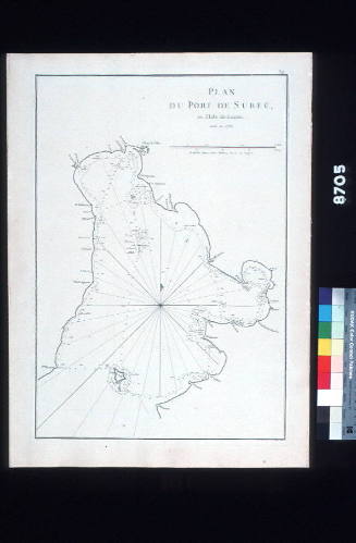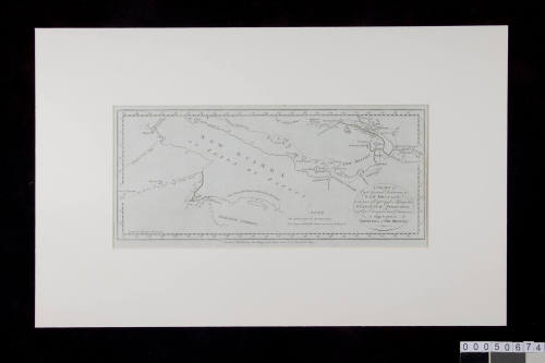
Chart of Captain Carteret's discoveries in New Britain
Publisher
Alexander R Hogg
(British, 1778 - 1824)
Date1784
Object number00050674
NameChart
MediumInk on paper
DimensionsOverall: 250 x 385 mm
Image: 150 x 357 mm
Image: 150 x 357 mm
ClassificationsMaps, charts and plans
Credit LineANMM Collection
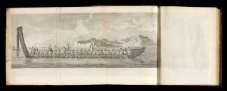
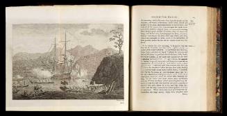
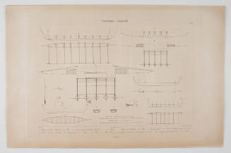
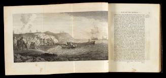
DescriptionBased on a chart which first appeared in Philip Carteret's account of his voyage around the world in HMS SWALLOW (1766-69) this chart includes Cook's route through Torres Strait (Endeavour Streights). It shows the extent of geographical knowledge of New Guinea, Northern Australia, New Ireland and New Britain towards the end of the 18th century.
HistoryPhilip Carteret (1733-1796) joined the Royal Navy in 1747 at age 14 and served on HMS SALISBURY. He served as Lieutenant on HMS DOLPHIN during John Byron's 1764-66 circumnavigation. In 1766 Carteret was given command of HMS SWALLOW to accompany Samuel Wallis in HMS DOLPHIN on a new voyage around the world. The two ships left England in August and arrived off the Strait of Magellan in December. After a gruelling four month passage of the strait, the vessels separated at Cape Pilar and did not meet again until returning to England. It was during this voyage that Wallis 'discovered' Tahiti.
During his circumnavigation in the SWALLOW Carteret discovered Pitcairn Island (named for the midshipman who sighted it). His route took him to the New Hebrides (now Vanuatu), Solomon Islands and Philippines before arriving off New Ireland.
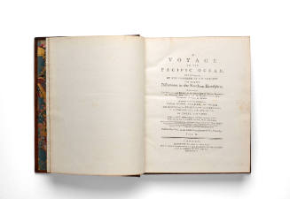
The SWALLOW proved a slow vessel and 24 crew died before the ship arrived at Batavia for repairs. It remained there for four months. Once repaired it sailed back to England via the Cape of Good Hope, St Helena and Ascension Island, finally arriving at Spithead in March 1769. Carteret's account of the voyage was edited by John Hawkesworth and published in volume 1 of Hawkesworth's Voyages in 1773.
In 1771 Carteret was promoted to the rank of captain and he subsequently served in the West Indies. He retired with the rank of rear-admiral in 1794.
SignificancePublished just four years before the establishment of a British settlement in Australia, this chart reflects developing knowledge of the area to Australia's north by English navigators during the 18th century. It is significant as part of the history of mapping Australasia.