Narrative of the Surveying voyage of HMS FLY, Volume 1
Author
Joseph Beete Jukes
(1811-1869)
Publisher
T&W Boone
Date1847
Object number00003573
NameBook
MediumInk on paper, boards, leather
DimensionsOverall: 224 x 152 x 24 mm, 0.85 kg
ClassificationsBooks and journals
Credit LineANMM Collection
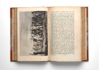
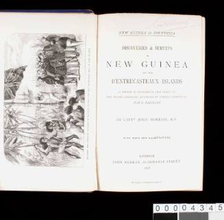
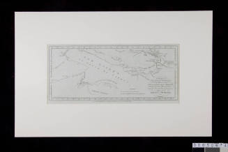
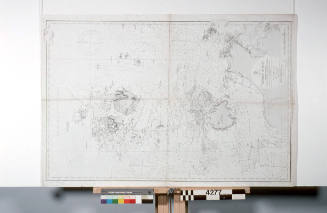
DescriptionThis book, titled 'Narrative of the Surveying Voyage of HMS FLY Commanded by Captain FP Blackwood, RN in Torres Strait, New Guinea, and Other Islands of the Eastern Archipelago, during the years 1842-1846: Together with an Excursion into the Interior of the Eastern part of Java' Volume I, was written by the English naturalist Joseph Beete Jukes. It details the voyage of HMS FLY to New Guinea, the Torres Strait Islands and the Great Barrier Reef. The 362-page book includes a comparative study of the languages spoken in parts of the Torres Strait, a study of 'Native Tombs' and funerary rites and accounts of the interactions with indigenous people.HistoryFrom 1842 to 1846, Captain Francis Price Blackwood commanded HMS FLY for the survey voyage of Torres Strait, New Guinea and the eastern Archipelago. One of the chief objectives of Blackwood's survey was to erect a beacon in a convenient spot to direct ships to the best channel through the Great Barrier Reef. After many trials at different points on the reef he settled one on Raine Island in 1844.
One of the great achievements of the voyage was the detailed survey of the channel around Darnley Island and the discovery of a route past PNG preferable to that through the Barrier Reef. This channel was then established as the principle passage through the Torres Strait.
Another significant product of the voyage, however, attracted attention for a different reason. In 1847, the naturalist Joseph Beete Jukes published detailed accounts of the expedition's activities in his ‘Narrative of the Surveying Voyage of HMS FLY Commanded by Captain FP Blackwood, RN in Torres Strait, New Guinea, and Other Islands of the Eastern Archipelago, during the years 1842-1846: Together with an Excursion into the Interior of the Eastern part of Java'. His account is a colourful narrative of the voyage; it details incidences of scurvy, shipwrecks and friendly and hostile exchanges with indigenous inhabitants.
Jukes also performed a detailed maritime study from the south-east coast of New Guinea and the Torres Strait Islands to the southern part of the Great Barrier Reef. In 1850, he published 'A Sketch of the Physical Structure of Australia: so far as it is at present known'. In it, he described Australia as 'the very land of uniformity and monotony, the same dull and sombre vegetation, the same marsupial type of animals....' Despite this, Jukes remained enthusiastic about the mineral wealth of New South Wales, emphasising the importance of undertaking more in-depth surveys. This text remains a significant historical contribution as it was the first published geological map of Australia.
SignificanceThe voyage of HMS FLY charted a safe passage through the Great Barrier Reef and Torres Strait, which allowed for the further development of trade between the Australian colonies and nations to the north. Jukes' account provides one of the earliest reports on the Indigenous peoples of New Guinea and, on the whole, remains a significant contribution to ethnographic and natural history.