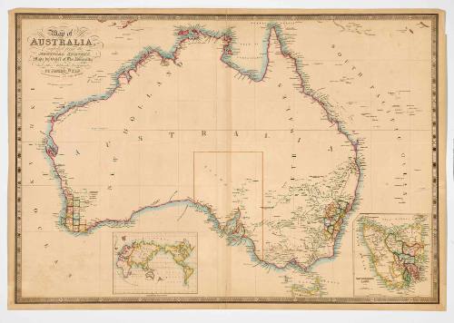
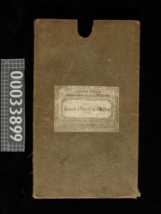
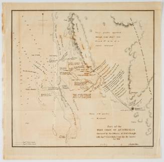
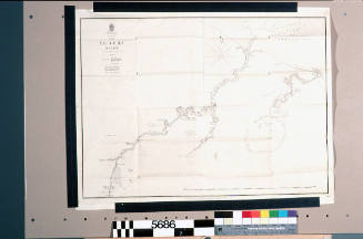
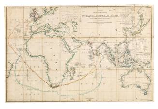
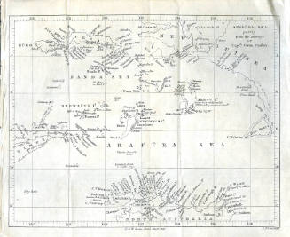
Map of Australia compiled from the Nautical Surveys Made by Order of the Admiralty, and other authentic documents by John Wyld Geographer to the Queen
Publisher
James Wyld
(1812-1887)
Date1841
Object number00000893
NameMap
MediumHandcoloured engraving on paper
DimensionsOverall: 555 x 803 mm
ClassificationsMaps, charts and plans
Credit LineANMM Collection
DescriptionMap of Australia by James Wyld, geographer to the Queen, published in 1841. Handcoloured steel engraved map entitled 'Map of Australia compiled from the nautical surveys made by the order of the Admiralty, and other authentic documents'.
This hand coloured engraved map of Australia shows one of the earliest official and complete surveys of the entire coastline. It highlights that even by 1841 very little of the inland areas of the continent had been officially surveyed or settled by Europeans.
HistoryJames Wyld (1812-1887) and his father James Wyld (senior) (1790-1836) were highly successful London map publishers. Both, in turn, served as royal geographers. James Wyld's firm was in operation from about 1837 to 1893 at addresses at Charing Cross and West Strand, producing a general variety of table and floor globes. Wyld is known for his construction of a Great Globe, 20 meters in diameter.
James Wyld (senior) took over William Faden's map-making business in 1823 and the quality of his work was recognised, being made Geographer to His Majesty (George IV and William IV) and HRH the Duke of York. Wyld senior was also a founding member of the Royal Geographical Society in 1830, and had worked in the Quarter Master General’s Office. He introduced lithography into British map printing in 1812. The prolific Wyld senior apparently ‘died from overwork’ .
The Wyld map publishing house was continued by James (junior) who entered the family business around 1830. James republished some of his father’s maps and guided the company towards becoming agents for the Ordnance Survey.
SignificanceThe high quality of James Wyld's maps was widely recognised, with Wyld appointed Royal Geographer. This is an excellent example of Wyld's work. It also highlights how the early cartographic knowledge of Australia was very much maritime based.
![Carte des Indes Orientale [Map of the East Indies]](/internal/media/dispatcher/238516/thumbnail)
Hydrographic Office of the Admiralty
1846