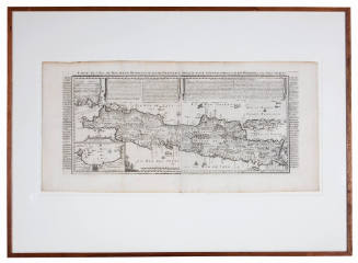
![Carte des Indes Orientale [Map of the East Indies]](/internal/media/dispatcher/238516/preview)
Carte des Indes Orientale [Map of the East Indies]
Cartographer
Pierre Du Val
(1619-1683)
Date1677
Object number00000919
NameMap
MediumHand coloured engraved map on paper
DimensionsOverall: 445 × 610 mm
Mount / Matt size (D Fini Mount): 630 × 865 mm
Mount / Matt size (D Fini Mount): 630 × 865 mm
ClassificationsMaps, charts and plans
Credit LineANMM Collection
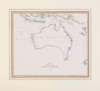
DescriptionMap of the East Indies centred on the Indian Ocean showing the east coast of Africa, Arabia, India, South East Asia and the west and north coasts of Australia. The map is titled 'Carte des Indes Orientales par P. Du Val geographie Ordinaire du Roy' [Chart of the East Indies by Pierre Du Val Geographer Ordinary to the King]. Publishing details lower left corner 'Paris chez l'Auteur pres le Palais, sur le quay de l'Orloge. Au coin de la rue de Harlay avecque privilege du Roy, pour vingt ans.1 / 1677'.
This hand coloured engraved map of the East Indies shows the Australian continent and includes details of early Dutch exploration.
HistoryPierre Du Val (1619-1683) was one of the most influential and prolific mapmakers and publishers working in Paris in the third quarter of the seventeenth century. He was the nephew of Nicolas Sanson, the leading French mapmaker of the period. Du Val became Geographer to the King of France from 1650 until his death in 1683.
His first atlas was the Cartes Geographiques Methodiquement Divisees published in 1654. This combined many earlier maps from French and Dutch geographers and mapmakers including Sanson, Mercator and Blaeu.
Following the publication of his Cartes de Geographie in 1657, Du Val published small sized, 'pocket atlases' which contained larger quantities of maps. Du Val's famous La Geographie Universeille was published in 1676.
After his death in 1683, his cartographic business was continued first by his widow Marie Desmaretz and then by his daughters, who published a large-sized atlas between 1688 and 1689.
SignificancePierre Du Val (Duval) was Royal Geographer of France from 1650 to 1683 and one of the most influential European mapmakers of the 17th century.
This map was produced in 1677 and clearly shows the combined European geographic knowledge of the Australian continent just prior to James Cook's first voyage of exploration along the eastern coastline.
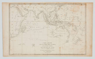
![Carte reduite de l'Ocean Oriental ou Mer des Indes [Reduced chart of the Eastern Ocean or Indian Sea]](/internal/media/dispatcher/169117/thumbnail)
Jacques Nicolas Bellin
1757