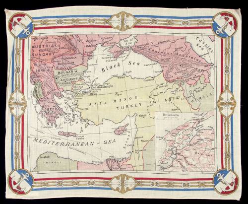
WWI scarf with a map of the Turkish Empire and an inset map of the Dardanelles
Date1914 - 1915
Object number00051332
NameScarf
MediumCloth
DimensionsOverall: 484 x 595 mm
ClassificationsCommemorative artefacts
Credit LineANMM Collection
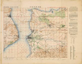
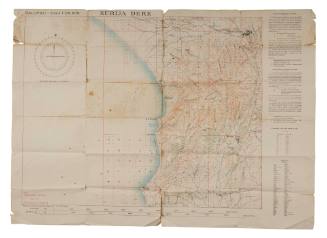
DescriptionCloth map depicting Turkey and surrounding countries with an inset map of the Dardanelles on the Gallipoli peninsula. It is a narrow strait of water approximately 60 km long and never more than 7 km wide that separates Europe from Asiatic Turkey. This cloth may have been produced by the Guardian newspaper as a souvenir and highlights the strategic importance of the straits and the Gallipoli campaign during World War I.HistoryThis cloth map depicts Turkey and surrounding countries with an inset map of the Dardanelles on the Gallipoli peninsula, a narrow strait of water approximately 60 km long and never more than 7 km wide that separates Europe from Asiatic Turkey. This cloth may have been produced by the Guardian newspaper as a souvenir and highlights the strategic importance of the straits and the Gallipoli campaign. On 19 February 1915 the Allies began a naval assault on the Dardanelles, opening up a new front in Turkey after progress on the Western Front had ground to a halt. The newly titled Royal Australian Navy provided support to the Gallipoli campaign with the most noted contribution from submarine HMAS AE2 and the RAN Bridging Train.
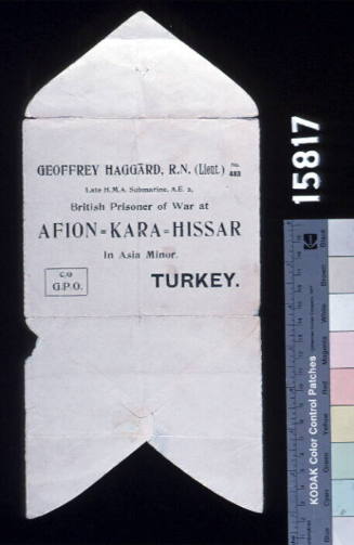
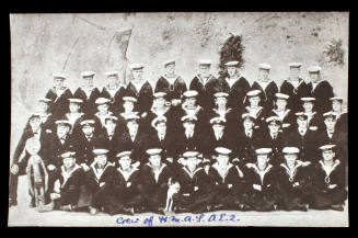
HMAS AE2 was the first allied warship to break through the dangerous waters of the Dardanelles in an attempt to block enemy traffic between Bosphorus and the Dardanelles. After five days of playing cat and mouse with enemy vessels during this voyage in April 1915, the submarine was hit by a torpedo from a boat of the Turkish Navy in the Sea of Marmora in April 1915 and the crew scuttled the vessel. All hands survived and were picked up by the torpedo boat, spending the next three-and-a-half years in a Turkish prison camp. The smaller inset image on the cloth shows a detail of the waters of the Dardanelles that HMAS AE2 traversed.
The RAN Bridging Train provided vital service to the troops and was the most highly decorated RAN unit during World War I. They reached Suvla Bay in August 1915, arriving under fire, to act as an engineering unit to support the British landings. They built and maintained wharves and piers, unloaded stores from lighters, controlled the water supply to the frontline troops, and stockpiled and repaired engineering equipment. When the decision to evacuate the peninsula was made just five months later, the RANBT continually repaired the wharves throughout the night time evacuation. A group of 50 remained until the last of the British rearguard were evacuated at Lala Baba Beach and thus were the last Australians to leave Gallipoli.
The Australian War Memorial collection also has a souvenir cloth map of the Dardanelles and western Turkey which shows a different image from a bird’s eye perspective.SignificanceSounvenir cloth depicting the Dardanelles during World War I. The Gallipoli campaign in Turkey is an important site in the development of Australia's defence forces.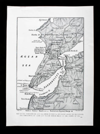
1915 - 1918


J W Norie and Company
1832