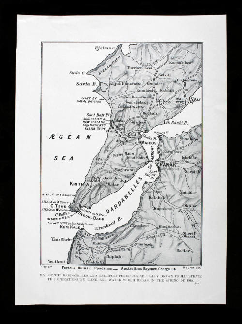
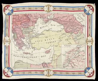
Dardanelles and Gallipoli peninsula
Publisher
Illustrated War News
Date1915
Object number00051851
NameMap
MediumPaper, printer's ink
DimensionsOverall: 312 x 235 mm
ClassificationsMaps, charts and plans
Credit LineANMM Collection
DescriptionThis map of the Dardanelles and Gallipoli peninsula was specially drawn to illustrate the operations by land and water which began in the spring of 1915 and featured in The Illustrated War News.
The Illustrated War News (first issue Volume 1, August 1914), was a weekly magazine during World War I. Upon the outbreak of the first World War the magazine Illustrated London News began to publish illustrated reports related entirely to the war and entitled it The Illustrated War News. The magazine comprised 48 pages of articles, photographs, diagrams and maps printed in landscape format. From 1916 it was issued as a 40 page publication in portrait format. It was reputed to have the largest number of Artist-correspondents reporting on the progress of the war.HistoryBritish interest centred upon the Dardanelles, the straits connecting the Aegean with the Sea of Marmara. If the Dardanelles could be forced, Constantinople could be bombarded into submission. The ease with which this might be accomplished was demonstrated by a successful naval bombardment of the southern Dardanelles forts on 31 October 1914, and the incredible feat of the tiny fifteen-man submarine B11 which, on 13 December, broke through the Turkish rninefields to penetrate The Narrows, where she torpedoed and sank the old battleship MESSUDIYEH.SignificanceThe Gallipoli campaign of World War I is synonymous with the ANZAC landings but there were other naval
campaigns including the initial bombardments of Turkish forts and batteries and subsequent landings of naval
and marine forces, as well as the submarine campaign in Turkish shipping lanes. This illustrated newspaper
report bring these events to life.

December 1914
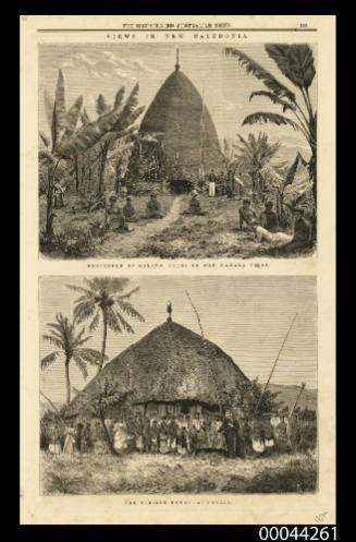
Gleason's Pictorial Drawing Room Companion
1853

Gleason's Pictorial Drawing Room Companion
1851-1855
Illustrated London News
8 December 1855