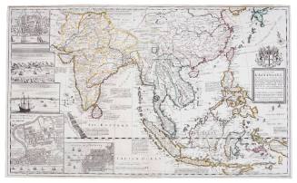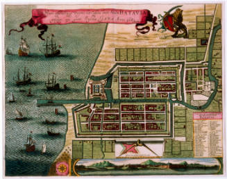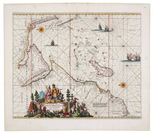
Occidentalior Tractus Indiarum Orientalium
Publisher
Frederick De Wit
(Dutch, 1630 - 1706)
Date1675
Object number00051288
NameMap
MediumLaid paper, printing ink, watercolour paints.
DimensionsOverall: 440 × 530 mm
Mount / Matt size (D Fini Mount): 630 × 865 mm
Mount / Matt size (D Fini Mount): 630 × 865 mm
ClassificationsMaps, charts and plans
Credit LineANMM Collection
DescriptionBeautifully detailed and decorated, this fine chart of the Indian Ocean and East Coast of Africa from the Cape of Good Hope to Cape Cormorin shows details of the adjacent coasts, islands and hazards encountered by ships trading between Europe and Asia.HistoryThe route from Europe to the Indian Ocean via the Cape of Good Hope was pioneered by Portuguese explorers at the end of the 15th century. The route opened the highly lucrative spice trade to new European powers, ultimately leading to the establishment of several national East-India companies. This is one of four charts of the coast of Africa that first appeared in Frederick de Wit's Zee Atlas of 1675.
Frederick De Wit (1630 - 1706)
After the decline of the Blaeu and Jansson publishing houses Frederick de Wit gained a reputation for the quality of his mapmaking. He managed to aquire a large number of copper plates at auction and with these he was able to cover almost every type of cartography: nautical charts, world atlases, books of town plans and panoramas and large scale wall maps.
Common to all his work was superb engraving and exceptional colouring resulting in maps of particular beauty and historic interest. His work was hugely popular and continued to be so after his death when many further editions were published.
SignificanceThis chart is significant both as a reflection of European knowledge of the Indian Ocean and the adjacent coasts in the 17th century, and as a fine example of a sea chart produced by the important Dutch map-maker Frederick de Wit.