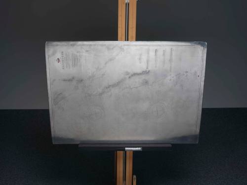
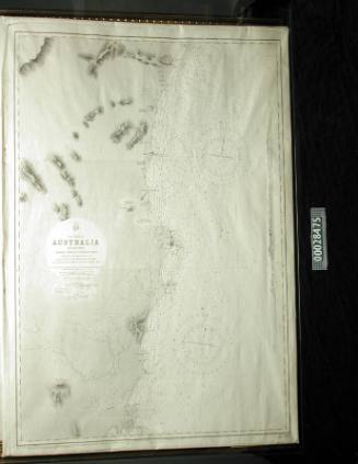
East coast of Australia; Tacking Point and Coffs Islands, to Evans Head
Artist
A J Boyle
Date1866-1954
Object number00028473
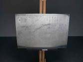
NameEngraving plate
MediumSteel, copper
DimensionsOverall: 980 x 670 mm, 17.3 kg
ClassificationsTools and equipment
Credit LineANMM Collection Transferred from Department of Customs and Excise
DescriptionThis engraving plate was used to print the chart 'East Coast of Australia; Tacking Point and Coffs Islands, to Evans Head'. It represents only a small section of Australia's 37,000 kilometre coastline. The final printed chart evolved from multiple surveys starting from Captain Cook's first charting of the east coast of Australia in 1770, and including changes as late as 1954.
Between 1864 - 1865 the coast was surveyed by Commander Frederick W Sidney of the Royal Navy, assisted by E P Bedwell and J T Gowlland. It was drawn by A J Boyle of the Hydrographic Office, and published at the Admiralty in 30 July 1866.HistoryBefore the establishment of the Australian Hydrographic Service in 1920, surveys of the Australian coastline were undertaken by the Royal Navy. The first Hydrographer to the Admiralty, Alexander Dalrymple, was appointed by King George III in 1795 to review naval difficulties in navigation. The Australian colonies funded ongoing surveys until the 1880s, and a cost sharing system continued through to the 1920s.SignificanceThis engraving plate is significant for its association with charting the coasts of Australia in the 19th century.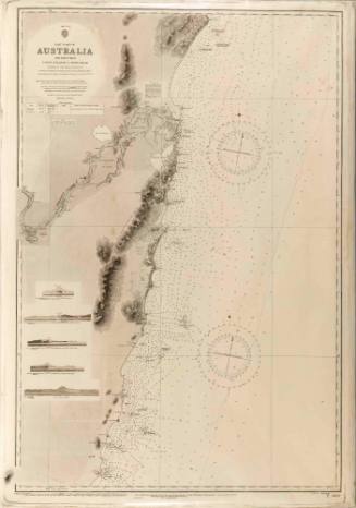
Commander Frederick W Sidney
1866
Commander Frederick W Sidney
1953
1900-1940

Hydrographic Office of the Admiralty
1953