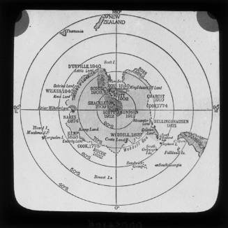
Handmade Map of Ross Island South Victoria Land and the Ross Barrier Surface
Cartographer
Sir Lionel Hooke
(Australian, 1895 - 1974)
Subject or historical figure
Sir Lionel Hooke
(Australian, 1895 - 1974)
Date1915
Object number00055439
NameMap
Mediumpaper
DimensionsOverall: 258 × 202 mm
ClassificationsMaps, charts and plans
Credit LineAustralian National Maritime Museum Collection Gift from Maria Teresa Hooke OAM and her sons John Max and Paolo in memory of John Hooke CBE and Sir Lionel Hooke
DescriptionA handmade map of Ross Island, South Victoria Land, and the Ross Barrier Surface. The map includes relevant reference points such as Ross Sea, Ross Barrier Surface and McMurdo Sound. Glaciers are marked with blue lines, whilst mountains are marked with blue dots. To differentiate between water and land, a green line delineates the boundaries. The map has a grid to mark coordinates.
The map is drawn in coloured and lead pencil on tracing paper, likely by Lionel Hooke who served as the wireless officer aboard SY AURORA, the Ross Sea Party supply ship for Shackleton’s Trans-Atlantic Imperial Expedition of 1914-17.
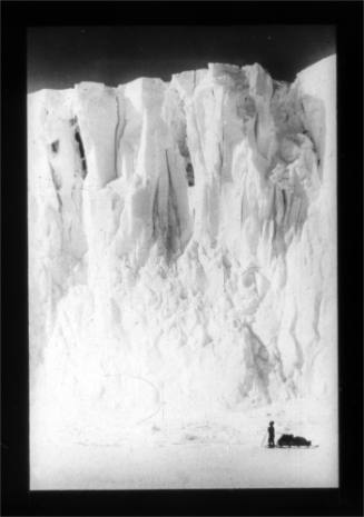
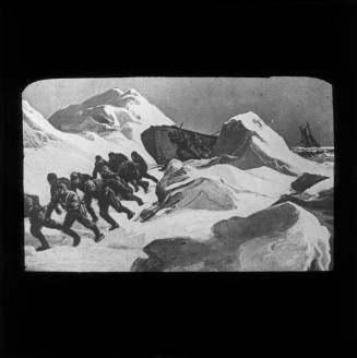
HistoryLionel Hooke was the wireless operator on SY AURORA, the Ross Sea Party's supply ship for Sir Ernest Shackleton's Imperial-Trans Antarctic Expedition of 1914-17. Then only 18 years old, Hooke left from Hobart in late December 1914 to McMurdo Sound, Antarctica, with the party tasked by Shackleton to sledge inland to lay deposits for him and his crossing party approaching from the Weddell Sea.
Hooke took part in sledging operations until AURORA broke its moorings during a blizzard in May 1915, abandoning ten of the supply party still ashore at McMurdo Sound including expedition leader Mackintosh. Hooke was one of 18 men marooned on the ship, now under the command of former first mate Joseph Stenhouse and trapped, drifting in ice for nine months.
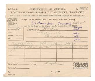
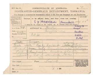
Hooke finally established wireless contact with the Naval Radio Station at Williamstown Victoria as the vessel limped towards New Zealand. The ship was at the time at least five times more distant than the normal range of its transmitting equipment. Aurora finally arrived in Port Chalmers, New Zealand in April 1916.
According to a report in the New York Times 14 May 1916 Hooke was widely applauded for his persistence, his resourcefulness and his inventiveness in continually overhauling his limited equipment, especially when jury-rigging an aerial to ice hummocks after a blizzard after Aurora was dismasted and the aerial carried away on 5 September.
Hooke later sailed to the UK to enlist in 1916, in the Royal Naval Volunteer Reserve and later the Royal Naval Air Service where he was trained as a pilot for the RNAS airships escorting convoys and patrolling for enemy submarines and mines.
Returning to Australia in 1919, Hooke joined Amalgamated Wireless Australasia where his interest in research and development saw him transmit the first live radio broadcast to legislators 12 miles away in Victoria's Parliament in 1920, oversee direct wireless telegraphy between Australia and the UK and the re-equipping and reorganisation of the Australian coastal radio network which AWA acquired in 1922. He also designed the automatic distress transmitter (patented 1929) which enabled emergency messages to be sent from ships that did not carry a radio operator. It was a forerunner to the EPIRB. During WWII he channelled AWA's resources to communications for Australian and American forces in the Pacific.
In 1945 Hooke became managing director and in 1962 succeeded his friend and mentor Sir Ernest Fisk as chair of AWA. He was awarded a knighthood in 1957 for his services to industry and coronation medals in 1937 and 1953.
SignificanceThis map is from the papers of Sir Lionel Hooke wireless operator on SY AURORA during Shackleton’s Imperial-Trans Antarctic Expedition of 1914-17. It is a significant original document from the so-called heroic age of Antarctic exploration showing the knowledge and legacy of exploration of that strategic area of the continent at that time.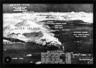
c 1912