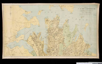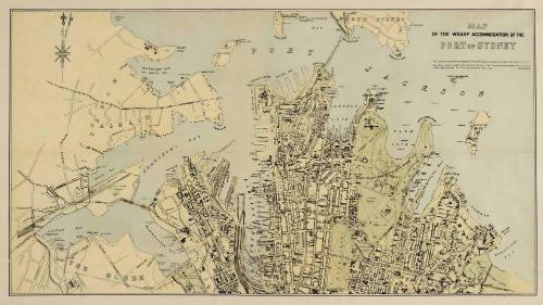
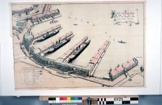
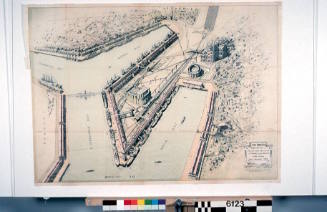
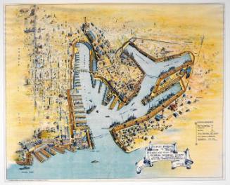
Map of the wharf accommodation of the Port of Sydney
Publisher
Sydney Harbour Trust
Datec 1920
Object number00004859
NameMap
MediumInk on paper
DimensionsOverall: 660 x 900 mm
Display Dimensions: 660 x 895 x 45 mm
Display Dimensions: 660 x 895 x 45 mm
ClassificationsMaps, charts and plans
Credit LineANMM Collection
DescriptionMap of the wharf accommodation of the Port of Sydney [Sydney Harbour Trust]. Existing commerical wharves are named on the map together with proposed jetties and wharves.HistoryThe Sydney Harbour Trust was formed in 1901 to administer the needs of the Port of Sydney. It operated until 1936 when it was replaced by the Maritime Services Board of NSW.
Higinbotham & Robinson
1893

Sydney Harbour Trust
1912