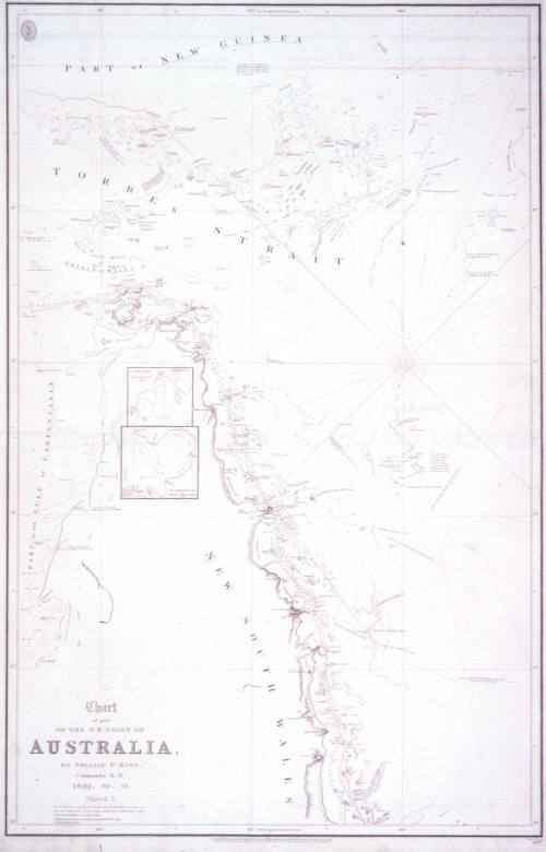
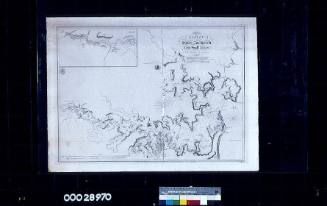
Part of the NE Coast of Australia by Phillip P King Commander RN 1819, 1820, 1821 Sheet 3
Cartographer
Admiral Phillip Parker King
(1791-1856)
Publisher
Hydrographic Office of the Admiralty
Date1829
Object number00004102
NameChart
MediumInk on paper
DimensionsOverall: 865 x 670 mm
ClassificationsMaps, charts and plans
Credit LineANMM Collection
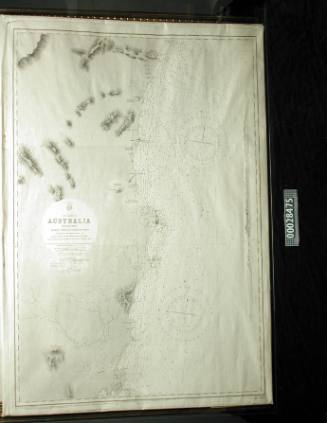
DescriptionThis chart of the Cape York and Torres Strait area was produced as part of Phillip Parker King's extensive re-surveys of Matthew Flinders's earlier work, 'corrected to 1822'. Other corrections by Lieutenant Roe up to 1829 are shown.HistoryPhilip Parker King (1793-1856), son of Philip Gidley King Governor of New South Wales between 1800-1806, was born on Norfolk Island in 1793. He was educated in England and joined the Royal Navy in 1807.
King has been considered one of Australia's greatest maritime surveyors. In 1814 he was assigned to survey the parts of the Australian coast not previously examined by Matthew Flinders, and sailed to New South Wales in 1817.
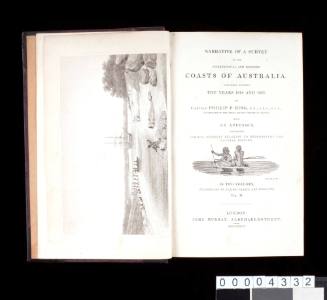
Between 1817 and 1822 on HMS MERMAID and then HMS BATHURST, he made four trips surveying and charting areas of the Australian coast line, later publishing some of his findings in 'Narrative of a Survey of the Intertropical and Western Coasts of Australia'.
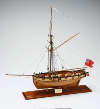
King made four voyages between December 1817 and April 1822. The first three were in HMS MERMAID, purchased by Governor Macquarie in 1817. Among the 19-man crew were the botanist Allan Cunningham and Bungaree an Aboriginal man from the Broken Bay area. Bungaree had come to prominence in 1798, when he accompanied Matthew Flinders on a coastal survey as an interpreter, guide and negotiator with local indigenous people. He also accompanied Flinders on his circumnavigation of Australia between 1801 and 1803. Flinders noted that the well travelled Bungaree was 'a worthy and brave fellow' who, on more than one occasion, saved the expedition. Bungaree was a prominent Aboriginal person in Sydney society for many years.
The Admiralty instructed King to discover whether there was any river 'likely to lead to an interior navigation into this great continent'. The Colonial Office had also given instructions to collect information about topography, fauna, timber, minerals, climate, as well as 'information on the natives and the prospects of developing trade with them'.
The MERMAID was built of Indian teak in Calcutta in 1816 and after a re-fit for the expedition, sailed from Port Jackson on the 21st of December 1817, surveying Twofold Bay, King George Sound and Exmouth Gulf. From Port Walcott the survey party went to the north coast of Arnhem Land and explored it westward from Goulburn Island and the King River, around the Cobourg Peninsula and into Van Diemen's Gulf as far as the West Alligator River. The MERMAID visited Melville and Bathurst Islands, called at Timor and the Montebello Islands, and returned to Sydney Cove on 29 July 1818. During this voyage Cunningham collected specimens of over 300 species, including several new ones from Arnhem Land. The crew had many encounters with Aboriginal people and Malaysian fishermen.
In December 1818 and January 1819 King surveyed the recently discovered Macquarie Harbour in Van Diemen's Land and sailed in May for Torres Strait. King took the explorer John Oxley as far as the Hastings River, and continued on to survey the coast between Cape Wessel and Admiralty Gulf. The MERMAID returned to Sydney on 12 January 1820.
The vessel had proven to be a most capable coastal survey ship and the MERMAID began her third voyage of exploration in July of 1820, with Cunningham the botanist again on board. It was King's intention to proceed with all speed along the east coast as before, to the north-west coast. However on the 20th July, while standing in at Port Bowen on the north-eastern coast, the MERMAID 'took the ground' and remained fast. With great effort by the crew, the ship was warped off into deeper water, where it was found that 'she had received considerable injury'.
The Mermaid was repaired and continued the voyage, however after constantly taking in water, King decided to return to Sydney. In a dramatic scene - immortalised in a painting by Conrad Martens - the leaky MERMAID was caught in a storm just short of Sydney, and after hitting a rock, limped in to the safety of Botany Bay, rounding Banks Headland during flashes of lightning.
On King's next voyage to the 'unknown north west coast' in 1821, he was forced to use a new ship, the BATHURST. The battered MERMAID had a short lived further career as a supply ship, but was wrecked on the Great Barrier Reef in 1829. The wreck was re-discovered by an ANMM led team in early 2009.
After being promoted to Commander, King spent five years surveying the coast of the Straits of Magellan in charge of the vessels HMS ADVENTURE and HMS BEAGLE. In later life he held the position as commissioner of the Australian Agricultural Company. Shortly before his death in 1856 he was appointed Rear Admiral on the retired list.
This chart was produced as part of King's extensive re-surveys of Matthew Flinders work, 'corrected to 1822'. Other corrections by Lieutenant Roe up to 1829 are shown.
SignificanceAdmiral Phillip Parker King has been considered one of Australia's greatest maritime surveyors. This chart of the Cape York coastline with its complex offshore reef systems is an excellent example of his extensive maritime survey work along the northern and western Australian coastlines from 1819-1821. 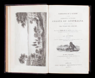
Admiral Phillip Parker King
1827
Admiral Phillip Parker King
1827

Commander Frederick W Sidney
1953