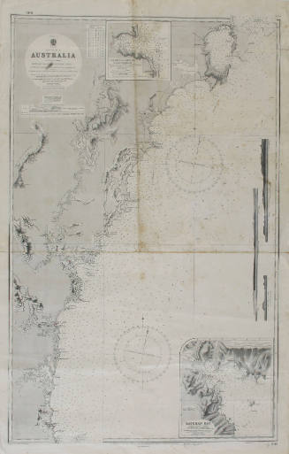
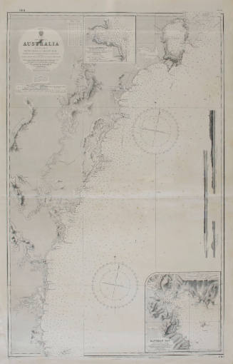
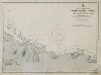
England south east coast, the Downs
Date1908
Object numberANMS0223[002]
NameChart
MediumPaper
DimensionsOverall: 1015 x 685 mm, 10 g
ClassificationsMaps, charts and plans
Credit LineANMM Collection Gift from Robert Laurence and Robert D McKilliam
HistoryNavigation chart no 1828, surveyed by Staff Commander Calver, RN 1865, and staff Commander Archdeacon, RN 1887 depicting the south east coast of England and outer soundings from Captain Bullock's survey of 1846
Hydrographic Office of the Admiralty
1949
Hydrographic Office of the Admiralty
1949
Hydrographic Office of the Admiralty
1947
Hydrographic Office of the Admiralty
1919
Hydrographic Office of the Admiralty
1942
Hydrographic Office of the Admiralty
1920
Hydrographic Office of the Admiralty
1920
Hydrographic Office of the Admiralty
1914