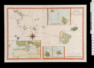
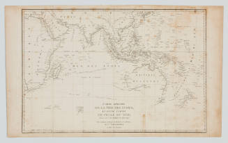
Archipel des Indes Orientales qui comprend les Isles de la Sonde Moluques et Philipines, tirees des cartes du Neptune Oriental
Engraver
Guillaume Delahaye
Cartographer
Didier Robert de Vaugondy
(French, 1723 - 1786)
Date1750
Object number00039674
NameMap
MediumInk on paper
Dimensions560 x 765 mm
ClassificationsMaps, charts and plans
Credit LineANMM Collection
SignificanceThe map is significant as part of a group of maps of SE Asia showing the changing geographic knowledge and exploitation of the region by European nations. The map is also indicative a new survey and cartography technologies emerging in the 18th century - technologies which are linked to the beginnings of national hydrographic departments.![Carte des Indes Orientale [Map of the East Indies]](/internal/media/dispatcher/238516/thumbnail)
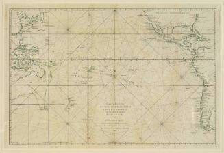
![Carte reduite de l'Ocean Oriental ou Mer des Indes [Reduced chart of the Eastern Ocean or Indian Sea]](/internal/media/dispatcher/169117/thumbnail)
Jacques Nicolas Bellin
1757