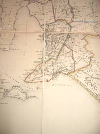
![Map of India [Southern part]](/internal/media/dispatcher/169122/preview)
Map of India [Southern part]
Publisher
Parbury, Allen & Co.
(British, 1827 - 1832)
Date1831
Object number00050671
NameMap
MediumPaper, ink, linen
DimensionsOverall (unfolded): 800 x 1545 mm
ClassificationsMaps, charts and plans
Credit LineANMM Collection
DescriptionThis 1831 map of India by John Walker is a grand format work indicative of the prestige of the Honourable East India Company and British power on the Indian subcontinent during the early colonial period of settlement in Australia. India provided a well-established network of trade and finance which did much to support the growth of Australia's colonies.HistoryJohn and Charles Walker were the sons of John Walker Snr who worked for Alexander Dalrymple, Hydrographer to the East India Company in 1779 and for the Admiralty in 1795. John took over as hydrographer in 1808 and when he died Sir Francis Beaufort (wind force scale) was appointed. John the younger also became hydrographer to the East India Company in 1836. He and Charles continued the family firm until 1890.
They were prolific engravers for other cartographers as well as for themselves and they published maps of India, the provinces, the Americas, as well as maps of the English and Welsh Counties.
J & C Walker had several offices including 47 Bernard St Russell Sq (from 1830 to 1836), 3 Burleigh St Strand (from 1837 to 1840), 9 Castle St Holborn (from 1841 to 1847) and 37 Castle St Holborn (from 1848 to 1875).SignificanceThis map of India is significant for its representation of the Indian subcontinent at a time when it was the most influential source of British influence in Asia with significant financial, social and trading links to the Australian colonies.
![Map of India [Northern part]](/internal/media/dispatcher/169123/thumbnail)
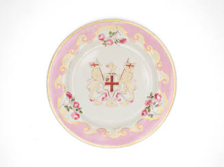
Flight, Barr and Barr (Royal Porcelain Works)
c 1817
![Carte des Indes Orientale [Map of the East Indies]](/internal/media/dispatcher/238516/thumbnail)
India and Australia Mail Steam Packet Company
1847
Samuel J Hood Studio
c 1924