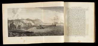
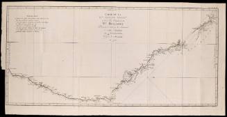
![A Chart of the Straights [sic] of Magellan](/internal/media/dispatcher/55846/preview)
A Chart of the Straights [sic] of Magellan
Printer
J Russell
Date1773
Object number00044386
NameChart
MediumInk on paper
DimensionsOverall: 550 x 795 mm
ClassificationsMaps, charts and plans
Credit LineANMM Collection
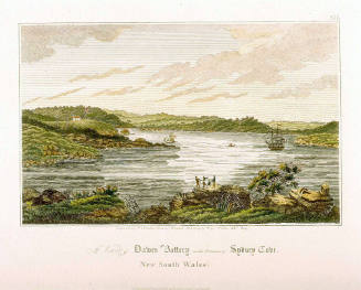
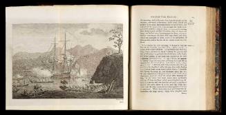
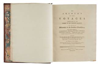
DescriptionThis chart shows the tracks and anchorages of Captains Byron, Wallis and Carteret through the torturous Strait of Magellan. Hand coloured detailing marking coastal vegetation, coastlines and islands were added at a later date. The upper section of the chart features three views of coastline: 'Cape Virgins', 'Cape Fairweather' and 'A View of Port Famine'. The chart was originally published in John Hawkesworth's 'Voyages' in 1773.HistoryCommissioned by the British Admiralty to edit Captain Cook's ENDEAVOUR voyage papers, John Hawkesworth published the three volume 'An account of the voyages undertaken for making discoveries in the Southern Hemisphere' in 1773. Known as Hawkesworth's Voyages, the volumes are a chronological account of the British voyages of discovery in the southern hemisphere, covering the voyages of John Byron (1764-66), Samuel Wallis (1766-68) and Phillip Carteret (1766-69), and James Cook (1768-71). Byron, Wallis and Carteret all entered the Pacific via the Straits of Magellan and the chart indicates the anchorages and route of each of these explorers. By contrast, Cook sailed south around Cape Horn to enter the Pacific, cutting many weeks off the passage to Tahiti. Cook's crew were relatively unaffected by scurvy, and the Cape Horn route was used by many subsequent explorers.
Following the end of the Napoleonic Wars and the liberation of Spain's South American colonies, British interest in South America was renewed. Between 1826 and 1833 the Admiralty sent successive ships (HMS ADVENTURE and HMS BEAGLE) to survey the Patagonian coast.SignificanceFrom the time of its discovery in 1520 by Ferdinand Magellan, the Strait of Magellan represented an important route for vessels entering the Pacific, however the passage was torturously slow and many crew members fell victim to scurvy. During Cook's ENDEAVOUR voyage he entered the Pacific by way of Cape Horn, and his example was generally followed by later explorers. In the 19th century, the Australian-born Phillip Parker King commenced the first detailed survey of Patagonia which was completed in 1833 by Captain Robert FitzRoy.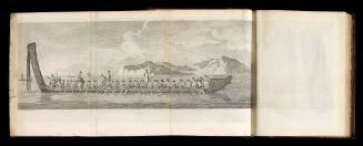

![Carte reduite de l'Ocean Oriental ou Mer des Indes [Reduced chart of the Eastern Ocean or Indian Sea]](/internal/media/dispatcher/169117/thumbnail)
Jacques Nicolas Bellin
1757