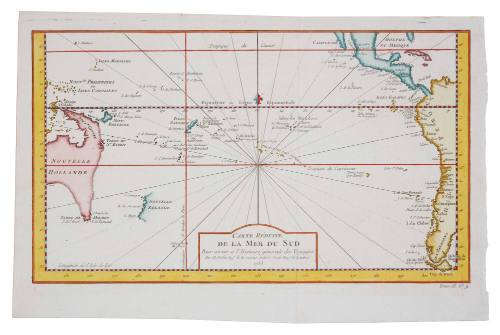
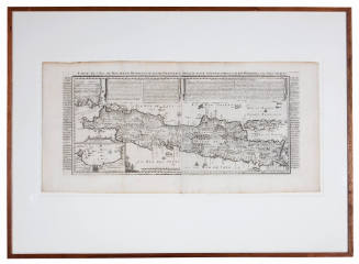
Carte reduite de la Mer du Sud
Cartographer
Jacques Nicolas Bellin
(French, 1703 - 1772)
Date1753
Object number00029303
NameMap
MediumPaper
DimensionsImage: 210 × 360 mm
Sheet: 252 × 390 mm
Overall: 220 × 385 mm, 0.008 kg
Mount / Matt size (B Fini Mount): 407 × 560 mm
Sheet: 252 × 390 mm
Overall: 220 × 385 mm, 0.008 kg
Mount / Matt size (B Fini Mount): 407 × 560 mm
ClassificationsMaps, charts and plans
Credit LineANMM Collection
DescriptionThis beautiful 1753 French chart of the Pacific Ocean by Jacques Nicolas Bellin reflects the limited European knowledge of the Pacific around the first half of the 18th century.HistoryJacques Nicolas Bellin (1703-1772) joined the French Hydrographic office (Dépot des Cartes et Plans de la Marine) in 1720 and worked there for over 50 years. In 1741 he was appointed Chief Hydrographer (Ingenieur Hydrographe de la Marine) and later became the Royal Hydrographer.
In 1764 Bellin published Le Petit Atlas Maritime (Le Petit Atlas Maritime recueil de cartes et plans des quatre parties du monde) in five volumes which contained several hundred maps. Among his other works are maps for l'Abbe Prevost's Histoire Generale des Voyages (Paris 1746-1757) of which this appears to be part. Bellin also produced many accurate and finely engraved separately issued maps.
The chart shows the state of knowledge of the Pacific Ocean in 1753. Details of Tasmania and New Zealand are based on Tasman's 1642- 44 discoveries. While the central Pacific is shown as largely unknown, the South American coast is shown in great detail with numerous place names.
SignificanceThis chart is the work of Jacques Nicholas Bellin - Hydrographer to the French King and depicts the Pacific Ocean in 1753 at a time when the east coast of Australia and most of New Zealand remained yet to be surveyed. The chart is integral to the story of Pacific exploration and discovery.
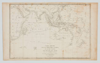
![Carte reduite de l'Ocean Oriental ou Mer des Indes [Reduced chart of the Eastern Ocean or Indian Sea]](/internal/media/dispatcher/169117/thumbnail)
Jacques Nicolas Bellin
1757
Jacques Etiene Victor Arago
1825