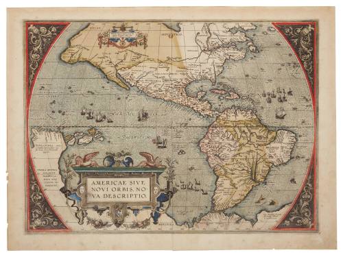
Americae sive Novi Orbis, Nova Descripto
Cartographer
Abraham Ortelius
(1527-1598)
Date1587
Object number00017246
NameMap
MediumHand-coloured copper plate engraving on paper.
DimensionsOverall: 404 × 544 mm, 0.018 kg
Display dimensions (C Fini Frame): 550 × 745 × 5 mm
Image: 354 × 488 mm
Mount / Matt size (C Fini Mount): 522 × 717 mm
Display dimensions (C Fini Frame): 550 × 745 × 5 mm
Image: 354 × 488 mm
Mount / Matt size (C Fini Mount): 522 × 717 mm
ClassificationsMaps, charts and plans
Credit LineANMM Collection
Purchased with USA Bicentennial Gift funds
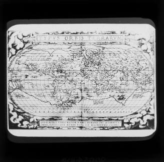
DescriptionHand coloured map by Abraham Ortelius titled 'Americae Sive Novi Orbis, Nova Descriptio' ['The Americas or the New World, a New Description']. The map was featured in Abraham Ortelius' 'Theatrum Orbis Terrarum', the first modern atlas of the world. 'Americae Sive Novi Orbis Nova Descriptio' is noted for being one of the most influential maps of the Americas from the sixteenth century.
The inscription relating to Australia reads 'Terra Australis sive Magellanica hactenus incognito' ['South Land or Magellanica hitherto unknown']. The Solomon Islands 'Insulae Salomonis' appear off Nova Guinea.HistoryOriginally published in 1570, this hand-coloured, engraved map of North and South America is from the original Latin edition of Abraham Ortelius's 'Theatrum Orbis Terrarum' (1570), considered the first modern atlas. This 1570 edition contained seventy maps that were bound into a book with an accompanying text. The maps were updated in subsequent editions, and the atlas continued to be published until 1612. The Theatrum was considered the most authoritative set of maps in the late sixteenth and early seventeenth centuries.
SignificanceThis map of the Pacific Ocean is important in that it highlights the confusion surrounding the location of Terra Australis. In this map it is shown as connecting to New Guinea. The importance of the American land mass as a base from which to launch exploratory expeditions is also apparent.
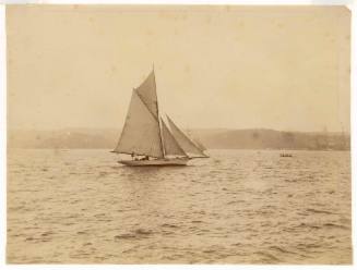
1901-1917
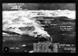
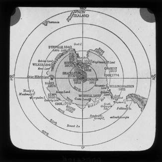
c 1912