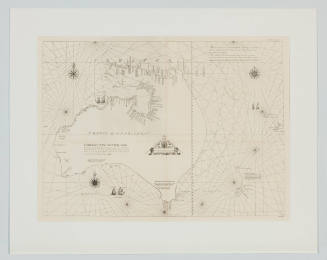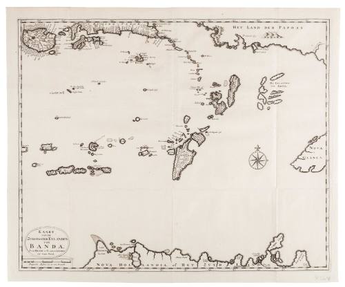
Kaart van de Zuyd-Ooster Eylanden van Banda
Publisher
Johannes Van Braam
(Dutch)
Publisher
Gerard onder de Linden
(Dutch)
Date1724
Object number00006999
NameMap
MediumInk on paper
DimensionsOverall: 488 x 590 mm, 0.05 kg
ClassificationsMaps, charts and plans
Credit LineANMM Collection
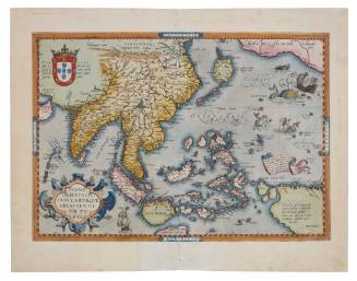
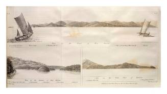
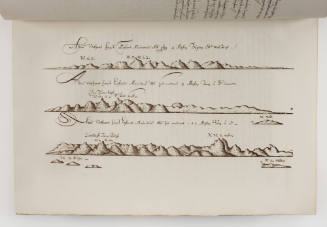
DescriptionA map of the seas and islands surrounding the Banda Islands, Indonesia (Dutch East Indies), extending south to northern Australia, east to Papua New Guinea and north to Seram. The map is titled 'Kaart van de Zuyd-Ooster Eylanden van Banda' and is taken from a work by François Valentijn (1666-1727) titled 'Oud en Nieuw Oost-Indiën'. The book outlines the history of the Dutch East India Company (VOC) which had been a highly secretive operation and was only begining, in its decline, to release any information on the area.
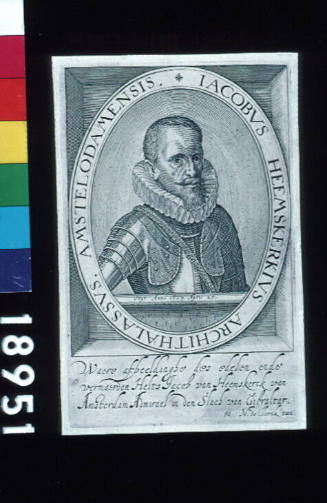
Australia on this map is marked as Nova Hollandia, New Guinea as Nova Guinea and Het Land der Papoas. Timor and the spice islands of Banda and Seram are depicted along the top of the map.HistoryFrançois Valentijn (1666-1727), was a Dutch missionary working at Amboina from 1684 to 1694 and 1705 to 1713. He travelled extensively in the VOC's lands taking an interest and extensive notes on the local inhabitants and environmental features he found. In 1719 back in Holland and having left his life as a missionary, Valentijn began his work on the VOC and its trading regions. This book would become known as 'Oud en Nieuw Oost-Indiën' and be a five volume publication comprising of his own extensive research and notes and "materials entrusted to him from former colonial officials".
So comprehensive was Valentijn's work that for many years "scholars consider[ed] this substantial work the first Dutch encyclopaedic reference for Asia.’Oud en Nieuw Ooost-Indiën' contains factual data, descriptions of persons and towns, anecdotes, ethnological engravings, maps, sketches of coastlines, and city plans, as well as excerpts of official documents of the church council and colonial administration."SignificanceThe Dutch East India Company (VOC) played a significant role in putting Australia (New Holland) on the map and during its peak had extensive military and exploratory capabilities which they guarded closely to protect their business.
Valentijin was one of the first to publish the company's history and the ethnographic and environmental features of the islands under their control.