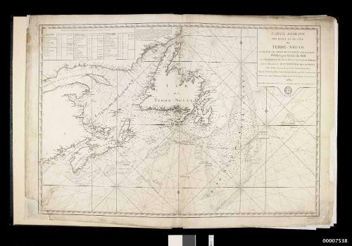


Newfoundland, St Pierre, Miquelon, 1763 - 1782
Cartographer
Captain James Cook
(English, 1728 - 1779)
Cartographer
Michael Lane
Cartographer
Jacques Nicolas Bellin
(French, 1703 - 1772)
Maker
M Fortin
(French)
Publisher
Depot General de la Marine
Date1784
Object number00007538
NameCharts
MediumCloth, Ink on paper
DimensionsOverall: 16 x 664 x 514 mm, 1.05 kg
ClassificationsMaps, charts and plans
Credit LineANMM Collection
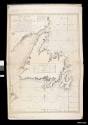
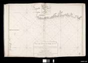
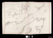
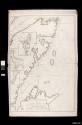
DescriptionThis bound volume of Newfoundland coastal surveys contains 11 charts, eight attributed to James Cook and Michael Lane in the GRENVILLE between 1763-7. Lane was master's mate and assistant surveyor to Cook in 1767-8 and carried on the surveys when Cook left to join the ENDEAVOUR in 1768.
Cook's charts of Newfoundland and Canada were progressively published from the 1760s, with a collection published in England in 1769 and then in the North-American Pilot in 1775.
After the Seven Years War (1756-1763) the islands of St Pierre and Miquelon remained the only French territories in the region. This volume was published in France in 1784. It also contains a general chart and two French surveys.
HistoryThe French and British had been competing for possession of Canada and Newfoundland, with its rich fishing grounds, since the 1600s. During the Seven Years War (1756-1763) against France, the main British base in Canada was at Halifax in Nova Scotia.
Cook sailed with the fleet to Canada, arriving in Halifax in May 1758. There he took part in the blockade of Louisbourg, which the French finally surrendered in July 1758. During this period he was taught how to survey and make charts by Samuel Holland, an army surveyor-engineer.
In 1759 the British commenced a major assault on the French stronghold of Quebec. Cook’s ship ferried troops and charted the approach to Quebec along the St.Lawrence River. The town fell to the British in September 1759 after an assault by the army of General Wolfe.
Cook’s talents as a surveyor and mapmaker had come to the notice of Admiral Saunders and he was transferred to the 70-gun ship NORTHUMBERLAND that remained in Canada as part of a small detachment for the next two years. Saunders returned to Britain where he arranged for Cook’s charts to be published. When the Seven Years War ended in 1763 the British realised the importance of having accurate charts of the coast and the Governor of Newfoundland commissioned Cook and others to produce them.
For the next five years Cook surveyed the coast of Newfoundland during the summer periods, returning to Britain for the winters. In 1762-63 Cook surveyed the coast of Placentia, south east Newfoundland; 1763-64 north Newfoundland; 1765 south Newfoundland; 1766 southwest Newfoundland; and 1767 west Newfoundland. He returned to London in November 1767, well placed to be chosen as commander of a planned expedition to the Pacific Ocean.
SignificanceThe charts are famous for their accuracy and detail. The charts of the so-called infinite mass of indentations, bays and harbours in Newfoundland and eastern Canada have been regarded as the finest of Cook's career.
Combined with his astronomical observations, the charts brought James Cook to the notice of the Royal Society and the Admiralty, and were the basis of his selection as commander of the ENDEAVOUR voyage.
Surviving French collected publications of the Newfoundland charts are rare.
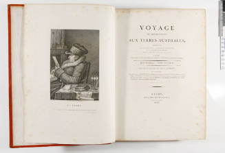
Jacques-Julien Houton de Labillardiere
1811
Commander Frederick W Sidney
1866-1954